


GLOBAL WEATHER FORECAST-2020 VEDIC METEOROLOGY
Article by: RAMACHANDRAN, Astro-Meteorologist.
I offer my sincere PRANAMS/THANKS to each and everyone for their encouragements & appreciations in recognizing my research based on VEDIC METEOROLOGY. I started publishing my GLOBAL WEATHER FORECAST only from 2018, though I am in this research for over 20 years.
I have been religiously validating my forecasts for the last two years in my Facebook page: https://www.facebook.com/ramachandran.seshadri
VEDIC METEOROLOGY is the ULTIMATE SCIENCE for the meteorologist to incorporate to produce FLAWLESS WEATHER FORECAST both LONG RANGE and SHORT RANGE. Applying VEDIC METEOROLOGY INTERPRETATIONS we can produce CATALOGUE OF GLOBAL WEATHER and EARTHQUAKES FOR THE NEXT 3000 YEARS.
Like the tiny squirrel which served Lord Rama in the construction of The “RamSethu Bridge”, I have done dependable base work for the forecasting of Weather and the Earthquakes. I am confident that my 20 years of research based on VEDIC METEOROLOGY has produced notable accurate forecasts to attract UNBIASED analysts. Though I conceive & improve on the methods to make my forecasts more accurate, I am looking forward to co-operations from experts of astronomy and meteorology to achieve it expediently.
MAIN POINTS:
As warned in my 2019 Global Weather Forecast, early winter during October resulted in Blizzard conditions with moderate to heavy snowfall and Icy rainfall. For the rest of 2019 I stand by my forecasts. I just wanted to ADD that there is a sure possibility of Severe Tropical Cyclone/Hurricane in the Gulf of Mexico during the second week of November, 2019. Even after crossing the coast of YUCATAN, this system will remain strong till 21st, November, 2019 & dump heavy to very heavy rainfall causing losses to life and property in Mexico & south USA
1 (a) Between the THIRD week of December, 2019 and the THIRD week of January, 2020 the northern hemisphere mid-latitude region will experience “Severe Winter condition” with spate of Blizzards, Heavy snowfall, Avalanches and Icy rainfall. These conditions will prevail in the North American continent, the Europe, Central Asia, China, Japan & North Indian states bordering the Himalayas.
1 (b) During the same period the Midlatitude region of the southern hemisphere will experience Very Hot conditions. There will be Typhoons, Tropical cyclones, Thunderstorms and Convective precipitation. The tropical region also will experience above normal temperature with squally winds, thunderstorms, Cell storms and Tropical cyclones. These conditions will prevail in Latin American countries, Central and southeast African countries, South Indian ocean countries, Indonesia, South Pacific countries, Australia and countries around it.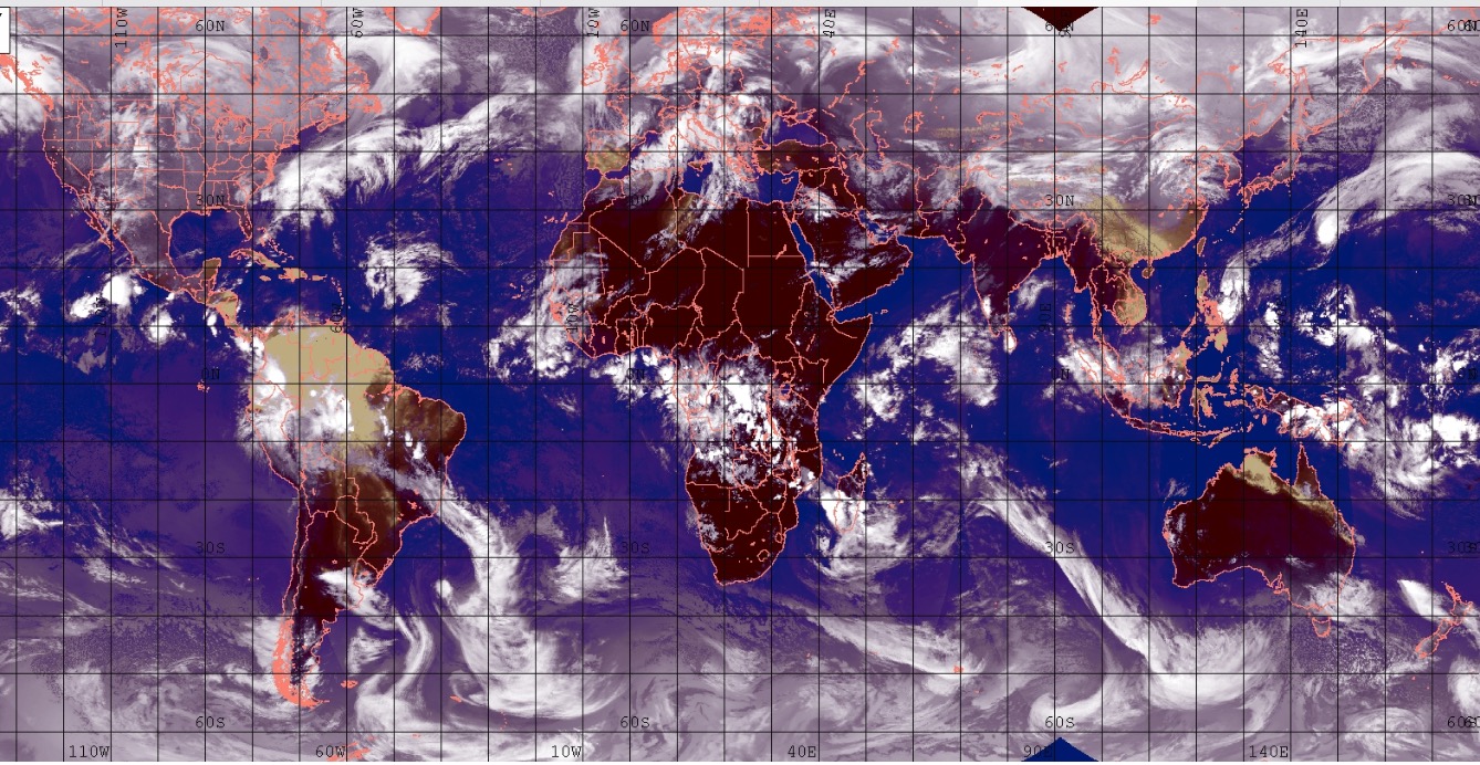
2 (a) Between the last week of January, 2020 and the last week of February, 2020 Powerful “Negative Indian Ocean Dipole” will be active. During the above period the northern hemisphere mid-latitude region will experience “Massive Snowfalls” coupled with blizzards, Avalanches and Icy rainfall. Heavy to Very heavy incessant rainfall will cause SEVERE WIDESPREAD FLOODING. Till the first week of February, 2020 “KILLER LIGHTNING” will cause devastations. These conditions will prevail in the North American continent, the Europe, Central Asia, China, Japan & North Indian states bordering the Himalayas.
2 (b) During the same period the Midlatitude region of the southern hemisphere and the tropical region will experience incessant Heavy to Very Heavy rainfall causing large scale flooding. ‘High Altitude & Hilly regions’ will experience record rainfall resulting in flash floods, landslides and mudflows. Till the first week of February, 2020 “KILLER LIGHTNING” will cause devastations. These conditions will prevail in Latin American countries, Central and southeast African countries, South Indian ocean region and South Pacific countries, Australia, New Zealand, Indonesia and countries around it.
3 (a) Between the last week of February, 2020 and the first week of May, 2020 Rapid & mercurial changes in the weather condition are forecast. “Strong Positive Indian Ocean Dipole” will be active during this period. During the above period the northern hemisphere mid-latitude region and its tropical region will experience “SPRING cum SUMMER”. During this period It will be “Progressively Very Hot with Record High Temperatures” will be registered; Extra-tropical cyclones, spate of Tornadoes, multiple thunderstorms, hailstorms and “KILLER LIGHTNING” will cause devastations. There will be Pre- season Hurricanes & Tropical cyclones causing losses to life and property. These conditions will prevail in the North American continent, the Europe, Central Asia, China, Japan & North Indian states bordering the Himalayas.
3 (b) During the same period “Strong Positive Indian Ocean Dipole” will be active and the Midlatitude region of the southern hemisphere and the tropical region will remain progressively VERY HOT and experience spate of Typhoons, Tropical cyclones, Tornadoes, squally winds cell storms, thunderstorms, Convective precipitation, Killer lightning etc.., These conditions will prevail in Latin American countries, Central & southeast African countries, South Indian ocean region & South Pacific countries, Australia, New Zealand, Indonesia and countries around it. South Asian countries will also experience these conditions.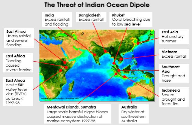
4 (a&b) Between the second week of May, 2020 and the second week of August, 2020 the world will experience incessant rainfall. Series of Hurricanes, Typhoons, Tropical cyclones Extra-tropical storms and TORNADOES are forecast during this period. Severe flooding, landslides and mudflows are forecast. Beginning the third week of June, 2020 till the end of July, 2020 KILLER LIGHNING sure to inflict fatalities among humans and livestock. These conditions will prevail in the North American continent, the Europe, Central Asia, China, Japan & North Indian states bordering the Himalayas, Peninsular India, South Asian countries, Equatorial & Southern tropic of Latin American countries, Northeast, Central, equatorial African countries and the Middle East will also experience these conditions. South Indian Ocean region and South Pacific countries Australia, New Zealand will experience blizzard conditions with heavy snowfall & icy rainfall.
5 (a&b) Between the third week of August, 2020 and third week of October, 2020 Very Strong ELNino will prevail. Between the first and last fortnights there will be “Vast noticeable and volatile difference” in weather condition. During this period it will be Very Hot and Dry, but spate of Hurricanes, Typhoons Tropical Cyclone, Tornadoes and localised thunderstorms sure to cause devastations. These conditions will prevail in the North American continent, the Europe, Middle East, Central & South East Asia, China, Japan & Indian states bordering the Himalayas, Peninsular India, South Asian countries, Equatorial & Southern tropic of Latin American countries, North, Central & equatorial African countries, will also experience these conditions. Catastrophic damages and causalities are warned due to strong storm winds and flooding due to Heavy to Very Heavy rainfall.
6 (a&b) Between the last week of October, 2020 and the third week of December, 2020 Heavy to Very heavy Incessant rainfall will cause SEVERE WIDESPREAD FLOODING in many countries. These conditions will be predominantly active in Peninsular India. South Asian countries, South Indian Ocean, South Pacific, Equatorial & West African countries, Europe and west Pacific countries will also experience these conditions. Till the first week of December, 2020 the northern hemisphere mid-latitude region and its tropical region also will experience the above conditions.
Strong winter will emerge from the second week of December, 2020. Mid-west, Lower mid-west and northeast states of USA, Central and east Canada will experience these conditions. Powerful “POLAR VORTEX” with strong blizzards will dump heavy to very heavy snowfall, Icy rainfall between 27th December, 2020 and 8th January, 2021. Spate of blizzards with heavy to very heavy snowfall will upset normal life till third week of February, 2021. In comparison with the last three years “2020/21 Winter will be moderate and Warmer”.
DETAILED FORECAST:
1 (a) Between the THIRD week of December, 2019 and the THIRD week of January, 2020 the northern hemisphere mid-latitude region will experience “Severe Winter condition” with spate of Blizzards, Heavy snowfall, Icy rainfall. These conditions will prevail in the North American continent, the Europe, Central Asia, China, Japan & North Indian states bordering the Himalayas.
Important dates for disaster preventive measures:
(1) Look for Heavy to Very Heavy snowfall/Icy rainfall between 14th & 20th December, 2019. Bomb cyclone with heavy to very heavy icy rainfall is forecast during the above period.
(2) Sever “POLAR VORTEX” with powerful blizzards sure to devastate between 22nd & 25th December, 2019. Severe Avalanches are warned during the above period,
(3) Blizzards with heavy to very heavy snowfall and ice rainfall sure to cause devastations between 2nd & 5th January, 2020 and again between 9th & 11th January, 2020. Devastations due to flash floods and Severe Avalanches are warned during the above period,
(4) Blizzards with heavy to very heavy snowfall and Bomb cyclone with ice rainfall sure to cause devastations between 14th & 22nd January, 2020. Heavy to Very Heavy snowfall/Icy rainfall will upset normal life between 16th & 18th January, 2020.
1 (b) During the same period the Midlatitude region of the southern hemisphere will experience Very Hot conditions. There will be Typhoons, Tropical cyclones and Thunderstorms. The tropical region also will experience above normal temperature with squally winds, thunderstorms, Cell storms and Tropical cyclones. These conditions will prevail in Latin American countries, Central and southeast African countries, South Indian ocean countries, Indonesia, South Pacific countries, Australia, and countries around it.
Important dates for disaster preventive measures:
(1) Localised storms with Heavy to Very heavy rainfall from 18th to 20th December, 2019. Northern Australian region namely Kimberley Plateau, Northern territory and North Queensland will benefit apart from Indonesia.
(2) Spate of Tropical cyclone(s)/Typhoons sure to cause devastations between 18th December and 25th December, 2019, (Botswana, Zimbabwe, Mozambique and Madagascar will get affected.)
(3) Another set of Tropical cyclones/Typhoon will upset normal life between 31st December, 2019 and 11th January, 2020 (Locations same as above) and
(4) Look for Tropical cyclones/Typhoons between 14th and 22nd January, 2020. Heavy to Very Heavy rainfall, thunderstorms, Cell storms will upset normal life between 17th & 20th January, 2020. (Locations same as above)
2 (a) Between the last week of January, 2020 and the last week of February, 2020 Powerful “Negative Indian Ocean Dipole” will be active. During the above period the northern hemisphere mid-latitude region will experience “Massive Snowfalls” coupled with blizzards and Icy rainfall. Heavy to Very heavy incessant rainfall will cause SEVERE WIDESPREAD FLOODING. Till the first week of February, 2020 “KILLER LIGHTNING” will cause devastations. These conditions will prevail in the North American continent, the Europe, Central Asia, China, Japan & North Indian states bordering the Himalayas.
Important dates for disaster preventive measures:
(1) Powerful blizzards with heavy to very heavy snowfall/Icy rainfall sure to cause flooding & devastations between 20th January and 26th January, 2020,
(2) Look for Severe flooding due to Heavy to Very Heavy snowfall/Icy rainfall with blizzards between 31st January & 2nd February, 2020 and again between 6th & 8th February, 2020;
(3) Blizzards with Massive snowfall/Icy rainfall sure to cause flooding & devastations between 12th & 17th February, 2020. Severe AVALANCHES are warned and
(4) Multiple storms and an extra Tropical cyclonic circulation between 18th February & 25th February, 2020 and also between 26th February & 4th March, 2020 sure to cause devastations. During the above periods it will be more Icy rainfall than snowfall sure to cause very severe flooding, landslides, and mudflows resulting in fatalities.
Very early Tropical cyclone/Hurricane in the Atlantic is possible between 26th February and 4th March, 2020. Tornadoes, thunderstorms, Hailstorms are also forecast during the above period.
2 (b) During the same period the Midlatitude region of the southern hemisphere and the tropical region will experience Heavy to Very Heavy rainfall causing large scale flooding. ‘High Altitude & Hilly regions’ will experience record rainfall resulting in flash floods, landslides and mudflows. Till the first week of February, 2020 “KILLER LIGHTNING” will cause devastations. These conditions will prevail in Latin American countries, Central and southeast African countries, South Indian ocean region and South Pacific countries, Australia, New Zealand, Indonesia and countries around it.
Important dates for disaster preventive measures:
(1) Look for Sub-Tropical cyclone/Typhoons dumping heavy to very heavy rainfall causing flash floods between20th January and 26th January, 2020.
(2) Between 1st February and 9th February, 2020 Sub-Tropical cyclone/Typhoons with Heavy to Very Heavy rainfall sure to cause massive flooding, (Botswana, Zimbabwe, Mozambique and Madagascar will get affected.)
(3) Look for another set of Tropical Cyclone, Typhoon between 13th February and 18th February, 2020. Heavy to Very Heavy rainfall during this period will result in severe flooding, massive landslides, mudflows; and
(4) Look for Powerful Tropical cyclones, Typhoo between 20th February and 5th March, 2020. Devastation due to cyclonic wind and severe flooding due to heavy to very heavy rainfall will cause fatalities. (Severe warning dates – 22nd to 25th Feb, 2nd to 5th March) Botswana, Zimbabwe, Mozambique and Madagascar will get affected; New South Wales and Queensland will experience Hailstorms)
 3 (a) Between the last week of February, 2020 and the first week of May, 2020 Rapid & mercurial changes in the weather condition are forecast. “Strong Positive Indian Ocean Dipole” will be active during this period. During the above period the northern hemisphere mid-latitude region and its tropical region will experience more “SPRING cum SUMMER”. During this period It will be “Progressively Very Hot and Record High Temperatures” will be registered. Extra-tropical cyclones, spate of Tornadoes, multiple thunderstorms, hailstorms, flash flooding and “KILLER LIGHTNING” will cause devastations. There will be Pre- season Hurricanes & Tropical cyclones causing losses to life and property. These conditions will prevail in the North American continent, the Europe, Central Asia, China, Japan, West Pacific & North Indian states bordering the Himalayas. ‘High Altitude regions’ in all the above regions will also experience these conditions.
Important dates for disaster preventive measures:
(1) Look for a powerful Tornadoes, Tropical Cyclone/Extra Tropical cyclone /Typhoon /Hurricane between 8th March, 2020 and 16th March, 2020. Catastrophic landslides, mudflows are warned during the above period,
(2) Devastations due to Tornadoes, Tropical Cyclone/Extra Tropical cyclone /Typhoon/ Hurricane are possible between 18th March, 2020 and 25th march, 2020,
(3) Between 27th March, 2020 & 2nd April, 2020 – Devastations due to Powerful Tornadoes, extra tropical cyclone, Typhoon/Hurricane/ localised thunderstorms are forecast.
(4) Again between 3rd April, 2020 and 9th April, 2020 another set of Tornadoes, Tropical cyclone, Hurricane sure to cause devastations. (First named Hurricane of the season?)
(5) Between 12th & 17th April, 2020 & again 19th & 27th April, 2020 – Look for another set of Powerful Tornadoes, extra tropical cyclone, Typhoon/Hurricane/ localised thunderstorms. Strong cyclonic winds with heavy to very heavy rainfall coupled with “KILLER LIGHTNING” will cause fatalities and
(6) Look for powerful Tornadoes, Tropical Cyclone/Extra Tropical cyclone /Typhoon/ Hurricane between 29th April, 2020 and 7th May, 2020. (Severe warnings – 4th/5th May)
 3 (b) During the same period “Strong Positive Indian Ocean Dipole” will be active and the Midlatitude region of the southern hemisphere and the tropical region will remain progressively VERY HOT and experience spate of Typhoons, Tropical cyclones, Tornadoes, squally winds cell storms, thunderstorms, Killer lightning etc.., These conditions will prevail in Latin American countries, Central and southeast African countries, South Indian ocean region and South Pacific countries, Australia, New Zealand, Indonesia and countries around it. South Asian countries will also experience these conditions. ‘High Altitude regions’ in all the above regions will also experience these conditions.
Important dates for disaster preventive measures:
(1)Between 8th & 12th March, 2020 and again between 13th & 17th March, 2020 – Look for series of Tropical cyclones/Typhoons localised thunderstorms causing severe flooding and devastation due to strong winds,
(2) Another set of Severe Tropical cyclones/Typhoons, localised thunder storms will upset normal life between 18th march, 2020 and 25th March, 2020. Devastations due to storms and flooding sure to cause fatalities,
(3) Fresh set of Severe Tropical cyclones/Typhoons, localised thunder storms are forecast between 28th March, 2020 and 9th April, 2020. Severe flooding and devastations due to severe storms & heavy rainfall are warned between 31st March and 3rd April, 2020 and again between 8th & 9th April, 2020,
(4) Between 11th April, 2020 & 16th April, 2020; again between 18th April, 2020 and 23rd April, 2020 series of Tropical cyclones/Typhoons localised thunderstorms are forecast. Flooding and devastations due to strong winds are warned,
(5) Another series of Severe Tropical cyclones/Typhoons, localised thunder storms are forecast between 26th April, 2020 and 6th May, 2020. “KILLER LIGHTNING” and devastations due to Strong winds and severe flooding will cause fatalities.
4 (a&b) Between the second week of May, 2020 and the second week of August, 2020 the world will remain hot and also experience fairly widespread incessant rainfall. Series of Hurricanes, Typhoons, Tropical cyclones Extra-tropical storms and TORNADOES are forecast during this period. Severe flooding, landslides and mudflows are forecast. Beginning the third week of June, 2020 till the end of July, 2020 KILLER LIGHNING and LANDSLIDES, MUDFLOWS will inflict fatalities among humans and livestock. These conditions will prevail in the North American continent, the Europe, Central Asia, China, Japan & North Indian states bordering the Himalayas, Peninsular India, South Asian countries, Equatorial & Southern tropic of Latin American countries, Northeast, Central, equatorial African countries and the Middle East will also experience these conditions. South Indian Ocean region and South Pacific countries Australia, New Zealand will experience blizzard conditions with heavy snowfall & icy rainfall. ‘High Altitude regions’ in all the above regions will also experience these conditions.
Important dates for disaster preventive measures:
(1)Between 11th May & 16th May, 2020 and again between 19th May & 25th May, 2020 – Due to persistent presence of strong extra tropical cyclonic system Widespread Heavy to Very Heavy rainfall will cause flooding. During the same period tropical Cyclones, Typhoons are forecast.
(2) Look for Powerful Hurricanes, Typhoons, Tropical Cyclones, extra tropical cyclonic system between 27th May, 2020 and 6th June, 2020 (Severe warnings – 29th May -1st June). During the above periods devastations due to strong winds and flooding due to Heavy to very Heavy rainfall will upset normal life and cause fatalities.
(3) Another series of powerful Hurricanes, Typhoons, Tropical Cyclones, extra tropical cyclonic system are forecast between 8th June & 15th June, 2020 and again between 16th June and 24th June, 2020. Devastations due to strong winds, flooding due to Heavy to very Heavy rainfall and “Killer Lightning” will upset normal life and cause fatalities.
(5) Between 26th June, 2020 and 6th July, 2020 – Look for Hurricanes, Typhoons, Tropical Cyclones, extra tropical cyclonic systems, and Localised thunder storms. (Severe warnings – 27 to 29th June). Flooding due to Heavy to heavy rainfall, strong winds and killer lightning will upset normal life. More devastation due to hurricane winds and severe flooding are warned between 3rd & 6th June, 2020.
(6) Another series of powerful Hurricanes, Typhoons, Tropical Cyclones, extra tropical cyclonic system are forecast between 10th July and 20th July, 2020. Severe flooding, thunderstorms with killer lightning will cause fatalities. (Severe Warnings -12th to14th July and 16th to 20th July, 2020)
(“VOLATILE WEATHER CONDITIONS” will prevail between the third week of July, 2020 and the third week of august, 2020. The SECOND FORTNIGHT of these months will experience “Dry and Hot” weather in comparison to the FIRST FORTNIGHT which will experience convective precipitations).
(7) Between 22nd July and 30th July, 2020 – it will be Dry & Hot in spite of overcast conditions. Isolated places will experience thunderstorms with heavy rainfall and killer lightning.
(8) Hurricane/Typhoons/Tropical cyclones which were emerging during the above period will become strong and will cause devastations between 31st July and 16th August, 2020. (Severe Warnings -31st July to 4th August and 10th to 16th August, 2020)
 5 (a&b) Between the third week of August, 2020 and third week of October, 2020 Very Strong ELNino will prevail. During this period it will be Very Hot and Dry, but spate of Hurricanes, Typhoons Tropical Cyclones, Tornadoes and localised thunderstorms sure to cause devastations. These conditions will prevail in the North American continent, the Europe, Middle East, Central & South East Asia, China, Japan & Indian states bordering the Himalayas, Peninsular India, South Asian countries, Equatorial & Southern tropic of Latin American countries, North, Central & equatorial African countries, will also experience these conditions. Catastrophic damages and causalities are warned due to strong storm winds and flooding due to Heavy to Very Heavy rainfall. During the above period the second fortnights of the months will experience DRY & HOT weather; while the first fortnights will experience volatile conditions convective precipitations with storms & flash flooding. The western and central Pacific will experience more hurricanes than the Atlantic.
Important dates for disaster preventive measures:
(1) Spate of Tornadoes, “DRY” Hurricanes, Typhoons, Tropical Cyclones, extra tropical cyclonic system and Tornadoes are forecast between 17th August, 2020 and 28th August, 2020,
(2) Spate of Tornadoes Hurricane, Typhoons, Tropical Cyclones and extra tropical cyclonic systems are forecast between 30th August, 2020 and 16th September, 2020. (Severe Warnings -31st August to 2nd September and 9th to 12th September, 2020). Hurricane is more likely to cross Lower California.
(3) Spate of Tornadoes, “DRY” Hurricanes, Typhoons, Tropical Cyclones, extra tropical cyclonic system are forecast between 14th September, 2020 and 26th September, 2020,
(4) Spate of Tornadoes Hurricane, Typhoons, Tropical Cyclones and extra tropical cyclonic systems are forecast between 27th September and 12th October, 2020. (Severe Warnings -27th September to 2nd October and 8th to 11th September, 2020). Hurricane is more likely to cross Lower California.
(5) Tornadoes, “DRY” Hurricanes, Typhoons, Tropical Cyclones, extra tropical cyclonic system and Tornadoes are forecast between 14th October & 17th October, 2020 and
(6) Spate of Tornadoes Hurricane, Typhoons, Tropical Cyclones and extra tropical cyclonic systems are forecast between 22nd October, 2020 and 31st October, 2020. (Severe Warnings -23rd October to 26th October and 29th to 31st October, 2020).
6 (a&b) Between the last week of October, 2020 and the third week of December, 2020 Heavy to Very heavy Incessant rainfall will cause SEVERE WIDESPREAD FLOODING in many countries. These conditions will prevail in be predominantly active in Peninsular India, South Asian countries, South Indian Ocean, south Pacific, Equatorial & West African countries and in Europe. Till the first week of December, 2020 the northern hemisphere mid-latitude region and its tropical region also will experience the above conditions.
Strong winter will emerge from the second week of December, 2020. Mid-west, Lower mid-west and northeast states of USA, Central and east Canada will experience these conditions. Powerful “ARCTIC BLAST”, “POLAR VORTEX” with strong blizzards will dump heavy to very heavy snowfall between 7th December, 2020 and 8th January, 2021. Spate of blizzards with heavy to very heavy snowfall will upset normal life till third week of February, 2021. Australia will ENJOY BOUNTYFUL MONSOON in 2021 after years of draught.
(1) Due to strong extra tropical cyclonic system/ sub-tropical cyclones moderate to heavy rainfall is forecast between 29th October, 2020 and 5th November, 2020. During this period also look for Hurricanes, Typhoons, and Tropical Cyclones. Beginning of flooding conditions will emerge during the above period.
(2) Due to strong extra tropical cyclonic system/ sub-tropical cyclones heavy to Very Heavy rainfall will cause “SEVERE FLOODING” between 7th November, 2020 and 17th November, 2020. During this period also look for Hurricanes, Typhoons, and Tropical Cyclones. (Severe Warnings 7th to 9th November and 12th to 17th November, 2020),
(3) Due to strong extra tropical cyclonic system/ sub-tropical cyclones heavy to Very Heavy rainfall will cause “SEVERE FLOODING” between 19th November, 2020 and 3rd December, 2020. During this period also look for Hurricanes, Typhoons, and Tropical Cyclones. (Severe Warnings 19th to 23rd November and 27th Nov. to 2nd December, 2020),
(4) Look for Powerful Typhoons, Tropical Cyclones, extra tropical cyclonic system between 5th December, 2020 and 15th December, 2020. Peak rainfall activities with strong storm winds are forecast between 7th & 15th December, 2020. Devastations due to powerful storm winds; SEVERE FLOODING due to Heavy to very Heavy rainfall will cause CATASTROPHIC DAMAGES to life and property and cripple normal life.
In the northern hemisphere Powerful “ARCTIC BLAST”, “POLAR VORTEX” with strong blizzards will dump heavy to very heavy snowfall between7th & 11th December, 2020; 13th & 21st December, 2020. Catastrophic damages to life and property will cripple normal life.
Severe winter with series of blizzards dumping heavy to very heavy snowfall/Icy rainfall are warned between (i)21st & 23rd December, 2020, (ii) 27th & 30th December, 2020, (iii) 5th & 7th January, 2021 and (iv) a series of Massive blizzards with Heavy to Very heavy snowfall & Icy rainfall are forecast between 9th January and 15th January, 2021. Catastrophic damages to life and property will cripple normal life.
 RAMACHANDRAN, Astro-Meteorologist.
sesh.ramachandran@gmail.com https://www.facebook.com/ramachandran.seshadri
Leave a Reply
You must be logged in to post a comment.