


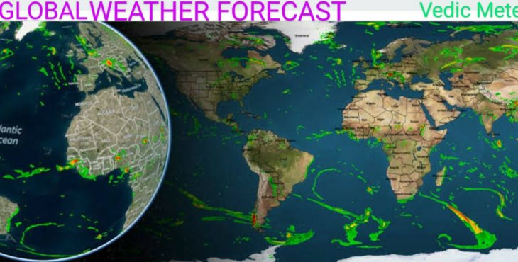
VEDIC METEOROLOGY
2022 GLOBAL WEATHER FORECAST
(Prepared during October-November, 2021)
I extend from the bottom of my heart my sincere PRANAMS/THANKS to all those people from different parts of the World for extending their overwhelming recognition, appreciation and encouragement for my research. Their overwhelming following of my forecasts since my first GLOBAL WEATHER FORECAST in the year 2018 prompted me to register the accuracy of my forecasts. Please check my forecasts @ https://tamilnadumandram.com & also https://independent.academia.edu/RamachandranSeshadri
I have been validating my forecast with the related weather events as and when they unfold and have been posting them in my “Twitter” & “Face book pages: https://twitter.com/seshchandran?s=08
https://www.facebook.com/ramachandran.seshadri
I humbly say that the armies of Modern Meteorologists’ mandatory dependence on Observational data even for their “VAGUE FORECASTS” a fortnight in advance exposes the limitations of the science they depend on. It’s obvious that it is “Impractical, Unimaginable” for access to “Observational data” YEARS IN ADVANCE; yet the “ULTIMATE FUNDAMENTALS” of “Vedic Meteorology Science” allows even a NOVICE like me to provide ‘Dependable Specific Long Range Weather Forecast’.
MAIN POINTS:
1) (A) [for the northern hemisphere mid-latitude region] From the last week of December, 2021 till early February, 2022 Blizzards with heavy to very heavy snowfall/Icy rainfall, Avalanches are forecast. From the first week of February, 2022 till the last week of March, 2022 “Warmer & wet Spring” is forecast. Hailstorms, localised thunderstorms tornadoes are warned during the above period. From the last week of March, 2022 till the second week of May, 2022 more widespread snowfall/Icy rainfall, hailstorms, devastating mid-latitude cyclones, tornadoes are warned during the above period. These conditions will prevail in the North American continent, Europe, Turkey, Central Asia, China, Japan & North Indian states bordering the Himalayas.
1) (B) [for the southern hemisphere mid-latitude region] From the last week of December, 2021 till early February, 2022 “Warmer conditions with above normal temperatures”, widespread heavy to very heavy rainfall, tropical cyclones, hailstorms are warned.
From the first week of February and till the last week of March flooding due to more widespread rainfall, devastating Tropical cyclone/Typhoon are forecast. During the second fortnight of February and March isolated rainfall and drier conditions are forecast. These conditions will prevail in South Pacific countries, Indonesia, Australia, New Zealand & countries around it, Latin American countries, Central, southeast African countries and South Indian Ocean countries.
2) (A) There will be TWO distinctively different weather conditions between the last week of March, 2022 and the second week of July, 2022: [a] Between the last week of March and the third week of May, 2022 emergence of “Positive Indian Ocean Dipole” is forecast. During the above period “Spring season” will be “VERY HOT with FAR ABOVE NORMAL TEMPERATURES”; spate of Powerful tornadoes, mid-latitude cyclones, Typhoons, Tropical cyclones, thunderstorms and “Killer Lightning” are warned; [b] Between the last week of May and the second week of July, 2022 mid-latitude cyclonic circulations related widespread heavy to very heavy rainfall will cause catastrophic flooding, fatalities and upset normal life. Hurricanes/Typhoons are warned from the last week of June till the second week of July, 2022. These conditions will prevail in the North American continent, Europe, Turkey, Middle-East countries, Central Asia, China, Japan & North Indian states bordering the Himalayas.
2) (B) The Mid-latitude region of the southern hemisphere and the tropical region will experience TWO distinctively different weather conditions from the last week of March, 2022 and the second week of July, 2022: [a] With the emergence of “Positive Indian Ocean Di-Pole” from the last week of March till the third week of May, 2022 the autumn season will be “Very Hot with Far Above normal Temperatures”. During the above period Tropical Cyclones, Cell storms, Hail storms, “Killer Lightning” and flash floods due to heavy to very heavy rainfall are forecast; [b] From the last week of May till the second week of July, 2022 due to persistent multiple low pressure/depression systems widespread heavy to very heavy rainfall causing severe flooding are forecast. Tropical cyclones/Typhoons are warned between the last week of June and the second week of July, 2022.
#Southern hemisphere “WINTER”: 2022 Winter over the Southern hemisphere will be recording “Lower temperatures “in comparison to 2021. Beginning June, 2022 till the third week of July, 2022 Blizzards, Widespread heavy to very heavy snowfall/Icy rainfall are forecast for the southern mid-latitude region, but the region bordering tropic of Capricorn will experience heavy to very heavy rainfall causing widespread flooding. From 2023 the Southern mid-latitude regions will be experiencing progressively “Harsher Winter” with 2025, 2026 and 2027 being peak years.
3) (A) & (B) Between the third week of July and the last week of September, 2022 emergence of Very Strong El Nino is forecast. During this period VERY HOT CONDITIONS with FAR ABOVE NORMAL TEMPERATURES are forecast, also Spate of Hurricanes, Typhoons, Tropical Cyclones mid-latitude cyclones and powerful tornadoes are warned. These conditions will prevail in the North American continent, Europe, Turkey, Central Asia, China, Japan & North Indian states bordering the Himalayas, Peninsular India, South Asian countries and Equatorial & Southern tropic of Latin American countries. The Northeast, Central, equatorial African countries and the Middle East will experience ‘Record Severe Heat Waves”. During the above period (ii) African countries below tropic of Capricorn and South Pacific countries Australia, New Zealand will experience Progressively Warm Winter & Dry Spring, Cell storms Hail storms with isolated heavy to Very heavy rainfall are forecast during September. The changes in the Global weather conditions over the northern hemisphere and the southern hemisphere will be progressing in a “Sine wave pattern”.
4) (A) Between last week of September, 2022 and the third week of October, 2022 Temperatures will remain “Far Above Normal” and widespread heavy to very heavy rainfall due to convective activities, mid-latitude wave cyclones and localised thunderstorms will cause Massive Flooding. Hurricane, typhoon & Killer lightning are warned during October, 2022. These conditions will prevail in the North American continent, Europe, Turkey, Middle-East countries, Central Asia, China, Japan, Northeast, Central, equatorial African countries & North Indian states bordering the Himalayas.
4) (B) From the last week of September till the third week of October, 2022 Widespread Heavy to Very Heavy rainfall and severe flooding are warned over the mid-latitude regions of the southern hemisphere and its “Torrid zone”. South Pacific countries, Indonesia & countries around it,, Australia, New Zealand, Latin American countries, Central, southeast African countries and South Indian Ocean countries will be experiencing these conditions. Tropical cyclones and Killer lightning are forecast during October, 2022. Australia and countries around it will experience “Hot, Humid & wet Spring” during the above period. Heavy to very heavy rainfall, landslides/mudflows will upset normal life.
5) (A) From the last week of October, 2022 till the end of December, 2022 temperatures will be above normal and catastrophic flooding due to mid-latitude wave cyclonic circulations, localised thunderstorms, landslide/mudflows and tornadoes will cause fatalities and upset normal life. #WINTER: Severe winter conditions with heavy to very heavy snowfall/Icy rainfall are forecast “From the second week of November, 2022 till the first few days of 2023”. These conditions will prevail in the North American continent, Europe, Turkey, Middle-East countries, Central Asia, China, Japan, Northeast, Central, equatorial African countries & North Indian states bordering the Himalayas. WARMER CONDITIONS with FAR ABOVE NORMAL TEMPERATURES, spate of tornadoes, (Blizzards till February, 2nd week), heavy to very heavy snowfall/Icy rainfall are warned from the first week of January, 2023 till third week of March, 2023. Catastrophic devastations, fatalities and flash floods will cripple normal life during the above periods.
5) (B) The mid-latitude regions of the southern hemisphere and its “Torrid zone”. South Pacific countries, Indonesia & countries around it,, Australia, New Zealand, Latin American countries, Central, southeast African countries and South Indian Ocean countries will be experiencing “Two distinctively different weather conditions between the last week of October, 2022 and till the end of December, 2022. (a) Tropical cyclones, Sub-Tropical cyclones, localised thunder storms with heavy to very heavy rainfall are forecast from the last week of October, 2022 till the second week of November, 2022.
(b) Widespread heavy to very heavy rainfall with KILLER LIGHTNING are forecast starting from the third week of November, 2022 till the last week of December, 2022. Conditions will be Very Hot with ‘Far Above Normal Temperatures” from the beginning of January, 2023 till the third week of March, 2023 due to the development of “Negative Indian Ocean Di-Pole”. During this period spate of Tropical cyclones, thunderstorms & Tornadoes will upset normal life. During the above period damages to life and property and “Severe Flooding “due to heavy to very heavy rainfall are warned.
DETAILED FORECAST:
1) (A) [for the northern hemisphere mid-latitude region] From the last week of December, 2021 till early February, 2022 Blizzards with heavy to very heavy snowfall/Icy rainfall, Avalanches are forecast. From the first week of February, 2022 till the last week of March, 2022 “Warmer & wet Spring” is forecast. Hailstorms, localised thunderstorms tornadoes are warned during the above period. From the last week of March, 2022 till the second week of May, 2022 more widespread snowfall/Icy rainfall, hailstorms, devastating mid-latitude cyclones, tornadoes are warned during the above period. These conditions will prevail in the North American continent, Europe, Turkey, Central Asia, China, Japan & North Indian states bordering the Himalayas.
Important dates for Preventive measures:
i) Powerful Blizzards with heavy to very heavy snowfall/Icy rainfall are warned between 5th and 16th January, 2022(peak dates 12th/13th January, 2022). Devastations due to Tornadoes are warned between 6th and 11th January, 2022,
(ii) Devastations due to Powerful Tornadoes are warned between 24th & 26th January, 2022. Blizzards with heavy to very heavy snowfall/Icy rainfall are warned between 24th and 30th January, 2022,
(iii) Early “Spring conditions will emerge from the first week of February, 2022. WIDESPREAD FLOODING due to Heavy to very heavy Icy rainfall/snowfall is forecast between 4th February and 15th February, 2022. Spate of Tornadoes warning issued for 3rd/4th February, 2022. Devastating BOMB CYCLONE, Typhoon/Cloud Burst/Tornadoes are warned between 9th February and 13th February, 2022,
(v)Widespread heavy to very heavy Icy rainfall than snowfall are warned between 21st February and 4th March 2022. During the above period “Bomb Cyclone, powerful Tornadoes and KILLER LIGHTNING are warned between 23rd and 27th February, 2022, Catastrophic flooding warned between 1st and 3rd March 2022,
1) (A) (vi) Tornadoes, Killer Lightning and heavy to very heavy Icy rainfall are warned between 8th March and 11th March, 2022. Spring conditions will become “Hot & Dry during the last two weeks of March, 2022.
1) (B) [for the southern hemisphere mid-latitude region] From the last week of December, 2021 till early February, 2022 “Warmer conditions with above normal temperatures”, widespread heavy to very heavy rainfall, tropical cyclones, hailstorms are warned. From the first week of February and till the last week of March flooding due to more widespread rainfall, devastating Tropical cyclone/Typhoon are forecast. During the second fortnight of February and March isolated rainfall and drier conditions are forecast. These conditions will prevail in South Pacific countries, Indonesia, Australia, New Zealand & countries around it, Latin American countries, Central, southeast African countries and South Indian Ocean countries.
Important dates for Preventive measures:
i) Widespread Heavy to Very heavy rainfall causing Severe Flooding is forecast between 9th & 17th January, 2022(Peak dates:9th to 11th Jan & 13th to 17th Jan, 2022). During the above period landslides/mud flows are warned, (ii) Devastating floods due to Sub-Tropical cyclonic circulation/Tropical Cyclone dumping Widespread Heavy to Very heavy rainfall/Cloud Burst are warned between 23rd Jan & 4th Feb, 2022. (Peak dates: 23rd to 27th Jan and 30th Jan to 4th February, 2022),
(iii) Due to severe Tropical Cyclone between 7th & 16th February, 2022 Widespread Heavy to Very heavy rainfall (Hail Storms) causing Severe Flooding is forecast. Landslides are warned during the second week of February, 2022 and the CYCLONE will CROSS the coast with devastating storm surge around 12th February, 2022 and will swing around causing more damages till 16th February, 2022,
(iv) CATASTROPHIC FLOODING due to Heavy to Very Heavy rainfall and CLOUDBURST are warned from 21st February to 25th February, 2022 and again between 28th February and 4th March, 2022(Peak dates:1st-2nd March) During the above periods Devastating CELL STORM and KILLER LIGHTNING are warned,
(v) Heavy to Very heavy rainfall is forecast from 9th to 11th March, 2022. Moderate to heavy rainfall is forecast at isolated locations between 20th and 26th March, 2022.
2) (A) There will be TWO distinctively different weather conditions between the last week of March, 2022 and the second week of July, 2022: [a] Between the last week of March and the third week of May, 2022 emergence of “Positive Indian Ocean Dipole” is forecast. During the above period “Spring season” will be “VERY HOT with FAR ABOVE NORMAL TEMPERATURES”; spate of Powerful tornadoes, mid-latitude cyclones, Typhoons, Tropical cyclones, thunderstorms and “Killer Lightning” are warned; [b] Between the last week of May and the second week of July, 2022 mid-latitude cyclonic circulations related widespread heavy to very heavy rainfall will cause catastrophic flooding, fatalities and upset normal life. Hurricanes/Typhoons are warned from the last week of June till the second week of July, 2022. These conditions will prevail in the North American continent, Europe, Turkey, Middle-East countries, Central Asia, China, Japan & North Indian states bordering the Himalayas.
Important dates for Preventive measures:
[a] (i) Look for a Powerful Tropical Cyclone/Typhoon between 30th March, 2022 and 5th April, 2022. Pacific Island Mindanao in Southern Philippines will be the likely location experiencing the above system. During the same period
“Devastating Tornadoes” are warned over Southeast, Ohio Valley & Northeast regions of US.
ii) Between 8th April and 18th April, 2022 another Powerful Tropical Cyclone/Typhoon is forecast. During the same period the Atlantic is likely to experience the first Tropical Cyclone/Hurricane of 2022 hurricane season.
iii) Isolated heavy to very heavy rainfall is forecast between 22nd April and 25th April, 2022 due to a depression, which will become a Tropical Cyclone/Typhoon/Hurricane and cross the coast around 2nd May, 2022. Flooding due to more widespread heavy to very heavy rainfall is forecast after 27th April till 2nd May, 2022,
iv) Look for another Typhoon/Tropical Cyclone/Hurricane between 5th May and 16th May, 2022. This system will cross the coast @ 16th May, 2022l causing more rainfall till 19th May, 2022. Devastations due to powerful storm and severe flooding due to heavy to very heavy rainfall are warned during the above period.
[b] (i) Powerful mid-latitude cyclonic circulations/Sub-Tropical cyclones will dump heavy to very heavy rainfall causing “CATASTROPHIC FLOODING” from the last week of May, 2022 till the second week of July, 2022:
Important dates for Preventive measures:
(1) From 21st May to 25th May, 2022, (2) from 28th May to 2nd June, 2022,
(3) 7th June to 9th June, 2022, (4) 12th June to 15th June, 2022,
(5) From 20th to 22nd June, 2022 (Tornadoes Warned) and
(6) From 25th June to 2nd July, 2022.
3) (A) & (B) Between the third week of July and the last week of September, 2022 emergence of Very Strong El Nino is forecast. During this period VERY HOT CONDITIONS with FAR ABOVE NORMAL TEMPERATURES are forecast, also Spate of Hurricanes, Typhoons, Tropical Cyclones mid-latitude cyclones and powerful tornadoes are warned. These conditions will prevail in the North American continent, Europe, Turkey, Central Asia, China, Japan & North Indian states bordering the Himalayas, Peninsular India, South Asian countries and Equatorial & Southern tropic of Latin American countries. The Northeast, Central, equatorial African countries and the Middle East will experience ‘Record Severe Heat Waves”. During the above period (ii) African countries below tropic of Capricorn and South Pacific countries Australia, New Zealand will experience Progressively Warm Winter & Dry Spring, Cell storms Hail storms with isolated heavy to Very heavy rainfall are forecast during September. The changes in the Global weather conditions over the northern hemisphere and the southern hemisphere will be progressing in a “Sine wave pattern”.
Important dates for Preventive measures:
i) Between 6th July, 2022 and 17th July, 2022 look for Powerful Typhoon /Hurricane in Atlantic/Tropical Cyclone in Mediterranean Sea & in Indian Ocean. These systems will dump heavy to very heavy rainfall from 6th July to 13th July, 2022 and swing around before crossing the coast around 16th July, 2022. “Killer Lightning” are warned till end of July, 2022 and again during the 2nd & 3rd week of August, 2022,
ii) Cat. 2 Hurricane in East Pacific/Very powerful Typhoon / Very Severe Tropical Cyclone in Mediterranean Sea & in the Indian Ocean are forecast between 19th July and 30th July, 2022. These systems will cross the coast first time around 22nd July, 2022 dumping heavy to very heavy rainfall from 20th to 23th July, 2022 swing around after 26th July and will cross the coast for the second time around 30th July, 2022,
iii) Between 2nd August and 13th August look for another Powerful Typhoon /Hurricane in Atlantic/Tropical Cyclone in Mediterranean Sea & in the Indian Ocean. From 5th to 7th August these systems will dump heavy to very heavy rainfall and will swing around and cross the coast around 12th August, 2022,
iv) Devastations due to Very Severe Typhoon/Cat-3 Hurricane in East Pacific & Atlantic/Tropical Cyclone in Mediterranean Sea & in the Indian Ocean are warned between 15th August and 27th August, 2022. These systems will dump Heavy to Very Heavy rainfall from 18th to 21st August, 2022 and swing around before crossing the coast around 26th August, 2022,
v) Between 29th August and 6th September look for Typhoon Pacific/Cat-2 Hurricane in East Pacific & Atlantic/Tropical Cyclone in Mediterranean Sea South Pacific & in the Indian Ocean, Heavy to Very Heavy Rainfall warned from 2nd to 6th September, 2022,
vi) Look for Typhoon in west Pacific/Hurricane in East Pacific & Atlantic /Tropical Cyclone in the Indian Ocean between 9th and 14th September 2022. Landslides, Mudflows are warned during the above period,
vii) Very Severe Typhoon/hurricane in Atlantic/Tropical Cyclone in Mediterranean Sea/South Pacific and in the Indian Ocean are warned between 15th September & 26th September, 2022. These systems will dump Heavy to Very heavy rainfall causing Severe floods from 17th September and will cross the coast as a WEAK SYSTEM or a Depression around 24th September, 2022.
(ii) African countries below tropic of Capricorn and South Pacific countries Australia, New Zealand will experience Progressively Warm Winter & Dry Spring, Cell storms Hail storms with isolated heavy to Very heavy rainfall are forecast during September.
Important dates for Preventive measures:
(1) Between 2nd & 6th September, 2022 mid –latitude tropical storms, Severe Cell storms/Hail storms are warned,
(2) Between 9th & 12th September, 2022 and again between 14th & 20th September, 2022 mid –latitude tropical storms, Severe Cell storms/Hail storms are warned and
(3) Heavy to Very Heavy Rainfall will cause “Catastrophic Flooding” due to Very Severe Mid –latitude tropical storms, Severe Cell storms/Hail storms between 23rd & 29th September, 2022.
4) (A) Between last week of September, 2022 and the third week of October, 2022 Temperatures will remain “Far Above Normal” and widespread heavy to very heavy rainfall due to convective activities, mid-latitude wave cyclones and localised thunderstorms will cause Massive Flooding. Hurricane, typhoon & Killer lightning are warned during October, 2022. These conditions will prevail in the North American continent, Europe, Turkey, Middle-East countries, Central Asia, China, Japan, Northeast, Central, equatorial African countries & North Indian states bordering the Himalayas.
Important dates for Preventive measures:
i) Between 2nd & 6th October, 2022,
(ii) Between 8th & 10th October, 2022,
(iii) Between 15th & 26th October, 2022 look for a Typhoon/ Hurricane in Atlantic/Tropical Cyclone in Mediterranean Sea/South Pacific and in the Indian Ocean. These systems will dump heavy to very heavy rainfall from 16th to 21st October and again from 23rd October before crossing the coast as a weak system around 26th October, 2022. Killer lightning and massive landslides/mudflows are warned during the above period.
4) (B) From the last week of September till the third week of October, 2022 Widespread Heavy to Very Heavy rainfall and severe flooding are warned over the mid-latitude regions of the southern hemisphere and its “Torrid zone”. South Pacific countries, Indonesia & countries around it,, Australia, New Zealand, Latin American countries, Central, southeast African countries and South Indian Ocean countries will be experiencing these conditions. Tropical cyclones and Killer lightning are forecast during October, 2022. Australia and countries around it will experience “Hot, Humid & wet Spring” during the above period. Heavy to very heavy rainfall, landslides/mudflows will upset normal life.
Important dates for Preventive measures:
i) Sub-Tropical cyclonic circulations related heavy to very heavy rainfall are warned between 2nd & 6th October, 2022, (ii) From 8th to 12th October, 2022, (iii) Between 14th and 20th October, 2022. (iv) Look for a Typhoon/Tropical Cyclone between 22nd and 30th October, 2022. These systems will dump widespread heavy to very heavy rainfall before crossing the coast around 27th October, 2022. Severe flooding, Landslides, Mudflows and Killer lightning during the above period will upset normal life.
5) (A) From the last week of October, 2022 till the end of December, 2022 temperatures will be above normal and catastrophic flooding due to mid-latitude wave cyclonic circulations, localised thunderstorms, KILLER LIGHTNING, landslide/mudflows and tornadoes will cause fatalities and upset normal life. #WINTER: Severe winter conditions with heavy to very heavy snowfall/Icy rainfall are forecast “From the second week of November, 2022 till the first few days of 2023”. These conditions will prevail in the North American continent, Europe, Turkey, Middle-East countries, Central Asia, China, Japan, Northeast, Central, equatorial African countries & North Indian states bordering the Himalayas. WARMER CONDITIONS with FAR ABOVE NORMAL TEMPERATURES, spate of tornadoes, (Blizzards till February, 2nd week), heavy to very heavy snowfall/Icy rainfall are warned from the first week of January, 2023 till third week of March, 2023. Catastrophic devastations, fatalities and flash floods will cripple normal life during the above periods.
Important dates for Preventive measures:
i) The effects of Cyclonic systems from the last week of October will continue and dump widespread heavy to very heavy rainfall causing Severe Flooding between 30th October and 3rd November, 2022,
ii) Polar Vortex, Bomb cyclone and Powerful Blizzards with “Record Snowfall”/Icy Rainfall are warned between 4th November and 11th November, 2022 (Polar Vortex on 9th November,’22). Devastating Tornadoes are warned between 5th & 8th November, 2022.
iii) Between 15th and 18th November, 2022 another series of Blizzards dumping heavy to very heavy Snowfall/Icy rainfall & Killer lightning are warned during the above period and till the first week of February, 2023.
iv) Devastating Tornadoes are forecast on 20th/21st November, 2022, and Blizzards from 20th to 26th November, 2022 are warned.
v) Another series of Blizzards dumping heavy to very heavy Snowfall and Icy rainfall are warned between 28th November and 3rd Dec ember, 2022 and again From 5th to 9th December, 2022, Tornadoes are warned on 2nd/3rd December, 2022,
vi) Again between 15th & 17th December, 2022 Tornadoes are warned. Powerful Blizzards dumping heavy to Very heavy snowfall/Icy rainfall will upset normal life between 15th December and 24th December, 2022,
vii) Tornadoes are warned from 29th to 31st December, 2022. Powerful Blizzards dumping heavy to very heavy Snowfall/Icy rainfall are warned between 29th December, 2022 and 7th January, 2023. During the above period Powerful ‘Bomb Cyclone” dumping heavy to very heavy Icy rainfall will cause Severe flooding and upset normal life. Avalanches warned during the above period.
viii) Very Powerful “Bomb Cyclone” causing Severe Flooding due to heavy to very heavy Icy rainfall is warned between 13th and 21st January, 2023. This system will swing around and cause flooding till 24th January, 2023. Blizzards with heavy to very heavy snowfall and Avalanches are warned during the above period. Tornadoes are warned on 13th/14th and around 26th January, 2023,
ix) Blizzards, Bomb Cyclone and series of Tornadoes are forecast between 28th January, 2023 and 6th February, 2023 and again between 10th February and 20th February, 2023,
x) Look for a Powerful Typhoon/Hurricane/Tropical Cyclone between 23rd February and 7th March, 2023. These systems will dump heavy to very heavy rainfall from 25th to 27th February, 2023, will swing around and cross the coast around 6th March, 2023,
xi) Telescopically more Powerful Typhoon/Hurricane/Tropical Cyclone and Devastating Tornadoes are forecast between 7th and 16th March, 2022.
5) (B) The mid-latitude regions of the southern hemisphere and its “Torrid zone”. South Pacific countries, Indonesia & countries around it,, Australia, New Zealand, Latin American countries, Central, southeast African countries and South Indian Ocean countries will be experiencing “Two distinctively different weather conditions between the last week of October, 2022 and till the end of December, 2022. (a) Tropical cyclones, Sub-Tropical cyclones, localised thunder storms with heavy to very heavy rainfall are forecast from the last week of October, 2022 till the second week of November, 2022.
Important dates for Preventive measures:
i) Look for Tropical Cyclone/Sub-Tropical cyclone between 30th October, 2022 and 9th November, 2022. These systems will dump heavy to very heavy rainfall, cross the coast for the first time around 4th November, 2022, finally around 9th November, 2022 and continue till 12th November,2022,
5) (B) (b) Widespread heavy to very heavy rainfall with KILLER LIGHTNING are forecast starting from the third week of November, 2022 till the last week of December, 2022. Conditions will be Very Hot with ‘Far Above Normal Temperatures” from the beginning of January, 2023 till the third week of March, 2023 due to the development of “Negative Indian Ocean Di-Pole”. During this period spate of Tropical cyclones, thunderstorms & Tornadoes will upset normal life. During the above period damages to life and property and “Severe Flooding “due to heavy to very heavy rainfall are warned.
Important dates for Preventive measures:
i) Localised Thunderstorms with Killer lightning and widespread heavy to very heavy rainfall is forecast between 15th and 18th November, 2022. KILLER LIGHTNING are warned till the first week of February, 2023,
ii) Sub-Tropical cyclone related widespread heavy to very heavy rainfall is forecast between 20th November and 27th November, 2022,
iii) Localised Thunderstorms with heavy to very heavy rainfall are warned from 30th Nov to 3rd December, 2022 & again from 5th to 9th December, 2022,
iv) Heavy to very heavy rainfall due to sub-tropical cyclone, localised thunderstorms are forecast from 16th December to 23rd December, 2022, iv) Look for a Powerful Tropical Cyclone between 29th December, 2022 and 7th January, 2023. Heavy to Very Heavy rainfall and flooding warned,
v) Between 13th January and 23rd January, 2023 Localised thunderstorms/ Sub-Tropical cyclone are forecast. These systems dump heavy to very heavy rainfall from 14th January will cross the coast around 20thJanuary, 2023,
vi) Powerful Tropical Cyclone/ Sub-Tropical cyclone is forecast between 27th January and 7th February, 2023,
vii) Look for Powerful Tropical Cyclone between 10th & 20th February, 2023,
viii) Powerful Sub-Tropical cyclone/Tropical Cyclone is forecast between 25th February and 7th March, 2023,
ix) Very Severe Tropical Cyclone/Sub-Tropical Cyclone is forecast between 9th March and 15th March, 2023. This system will cross the coast around 14th/15th March, 2023 and continue its devastations till 22nd March, 2023.
S. RAMACHANDRAN, Vedic Meteorologist
sesh.ramachandran@gmail.com
https://www.facebook.com/ramachandran.seshadri
https://twitter.com/seshchandran?s=08
Leave a Reply
You must be logged in to post a comment.