

2022 Annual Weather Forecast (Vedic Meteorology)
For the Indian Sub-Continent (Prepared during October-November, 2021)
Research & Article By : Puyal Ramachandran
Main Points:
A) (1) Winter above the Vindhyas will be “Normal & Subdued” from the last week of December, 2021 till the last week of February, 2022. During this period few Blizzards and heavy to very heavy Snowfall and Icy rainfall are forecast. Early Spring conditions will emerge from 16th February, 2022. Less snowfall and isolated heavy to very heavy rainfall (Hail storms) is forecast till the last week of March, 2022. A (2) During the same period the southern peninsula below the Vindhyas will experience “Warmer, Rainy & Dry Winter”. Above Normal “Warmer Conditions” will emerge from the beginning of March, 2022. Moderate rainfall during the first fortnight of March, 2022 and Dry weather during the second fortnight is forecast. Rainfall will be more widespread in the southern peninsula during the above period.
B) “Strong Positive Indian Ocean Di-Pole” is forecast from the last week of March, 2022 till the third week of May, 2022. Very Hot conditions with “Far Above Normal Temperatures”, Tropical Cyclones, Sub-Tropical cyclonic circulations and squally winds with thunder storms are forecast during the above period. “Moist & Humid conditions” will prevail during “The first 15 days” of the above period, but “Hot & Dry conditions” will prevail during “The second 15 days” till the third week of May, 2022. Peninsular States and Central States of India will experience the above conditions more than Northern states of India.
C) Early onset of “Southwest Monsoon 2022” is forecast between 22nd May, 2022 and 26th May, 2022. Rainfall during Southwest Monsoon 2022 will be indifferently distributed among the southern peninsular states and the northern states of India from the last week of May, 2022 until the second week of July, 2022. This will be the first period of best rainfalls during Southwest Monsoon 2022. Central states and the southern peninsular states will experience “Hot conditions with Far Above Normal Temperatures”.
D) “Poor Rainfall” and “Draught Conditions” will emerge due to the development of “STRONG EL NINO” between the third week of July, 2022 and the last week of September, 2022. During the above period conditions will be “Very Hot & Dry” and “Far Above Normal Temperatures” will prevail throughout North and Central States of India. Southern peninsular Indian states will also experience moderately above normal “Dry & Hot conditions. During the above period Squally winds thunderstorms, Sub-Tropical Cyclonic circulations and Tropical Cyclones related rainfalls on isolated periods are forecast. Effective propaganda is must to avoid fatalities due to “KILLER LIGHTNING” from the second week of July till the third week of August, 2022. From the last week of September, 2022 Southwest monsoon will continue till the third week of October, 2022. This will be the second period of best rainfall of Southwest Monsoon 2022. Eastern, Central and Southern peninsular states will get maximum benefits and the West, Northwest will remain mostly dry. Overall 2022 Southwest Monsoon will be Weak & Indifferent with 40 to 50 % Deficit rainfall resulting in “Severe Draught Conditions”. West & Northwest states will be worst affected.
E) Withdrawal of 2022 Southwest monsoon and the “Onset of Northeast Monsoon 2022” will be simultaneous. Northeast Monsoon will set between 20th & 23rd October, 2022. Beginning with a “Deep depression/Moderate Cyclone” Northeast Monsoon 2022 will yield low pressure trough related rainfall till the first week of January, 2023. Simultaneous ‘Low Pressure systems” in the Bay of Bengal and the Arabian sea are forecast during second week of January, 2023. The Low Pressure system in the Bay of Bengal will become a Cyclone and will cross the coast between Cuddalore and Chennai around 8th January, 2023. Overall “Near Normal rainfall” is forecast for the Northeast monsoon season 2022.
#WINTER 2022: Above the Vindhyas Winter will be Subdued. Heavy to very heavy snowfalls/Icy rainfalls and “Avalanches” are forecast from the beginning of third week of November, 2022 till end of December, 2022. Sub-Himalayan region will experience Spate of Blizzards with Heavy to Very Heavy Snowfall/Icy Rainfall upsetting normal life from the beginning of January, 2023 till early March, 2023. Avalanches are warned during the above period.
Fog, Smog and Air Pollution in the Northern States of India will be “More than what was experienced during 2021”. Meteorologists’ have been ignoring/ not realizing the involvement of “Axis & the plane of active upper air circulations” in causing “More Air Pollution” during certain years of every decade.
Winter over the Southern Peninsula will be “Wet and Warmer”. From the second week of January,2023 till the third week of March 2023 squally winds thunderstorms, Cyclonic Circulation related abnormal rainfall at many places in & around the districts below 10 degree latitude and also at isolated places in the hilly regions are forecast. Flash floods are warned during the above period.
Detailed Forecast:
A) (1) Winter above the Vindhyas will be “Normal & Subdued” from the last week of December, 2021 till the last week of February, 2022. During this period few Blizzards and heavy to very heavy Snowfall and Icy rainfall are forecast. Early Spring conditions will emerge from 16th February, 2022. Less snowfall and isolated heavy to very heavy rainfall (Hail storms) is forecast till the last week of March, 2022.
Important dates for Preventive measures:
a) Blizzards with heavy to very heavy snowfall/icy rainfall are forecast between 26th December, 2021 and 3rd January, 2022,
(b) Severe Blizzards with heavy to very heavy snowfall/icy rainfall are warned from 7th to 16th January, 2022 (peak dates 9th to 11th January, 2022 & 13th to 16th January, 2022 – Avalanches),
(c) Severe Blizzards with heavy to very heavy snowfall/icy rainfall are warned between 25th January, 2022 and 31st January, 2022. Avalanches are warned during this period.
(d) Very Severe Blizzards are warned between 3rd February, 2022 and 13th February, 2022. Avalanches are warned on 3rd, February, 2022 & again from 8th February, 2022 to 13th February, 2022,
(e) Early Spring conditions will emerge from 16th February, 2022. Less snowfall and isolated heavy to very heavy rainfall (Hail storms) is forecast till the last week of March, 2022. Peak dates: (i) 21st to 25th February, 2022, (ii) 28th February, 2022 to 4th March, 2022, (iii) 8th to 15th March, 2022.
A (2) During the same period the southern peninsula below the Vindhyas will experience “Warmer, Rainy & Dry Winter”. Above normal “Warmer Conditions” will emerge from the beginning of March, 2022. Moderate rainfall during the first fortnight of March, 2022 and Dry weather during the second fortnight is forecast. Rainfall will be fairly widespread in the southern peninsula during the above period.
Important dates for Preventive measures:
a) Between 26th December, 2021 and 3rd January, 2022, TamilNadu, Kerala and Karnataka will experience Moderate to heavy rainfall.
(b) Look for a Cyclone/Deep depression around southeast Arabian Sea/adjoining Gulf of Mannar between 7th January and 16th January, 2022. With heavy to very heavy rainfall this system will breach the coast between Cochin & Kozhikode around 9th-13th January, 2022 and will continue to travel inland causing widespread flooding till 17th January, 2022.
c) Between 19th January, 2022 and 27th January, 2022 look for Deep depression in the Bay of Bengal. Dumping heavy to very heavy rainfall from 21st January, 2022; this system will cross the coast 25th/26th January, 2022 between Nagapattinam and Pondicherry and will continue to travel inland till 30th January, 2022.. Flash floods are warned during the above period.
d) Severe Cyclone is “POSSIBLE” between 3rd February, 2022 and 13th February, 2022. This Cyclone will dump heavy to very heavy rainfall from 4th February, 2022 and will cross the coast around 9th/10th February, 2022 between Cuddalore & Nellore (OR) will drift away towards Bangladesh-Myanmar coast.
e) “CLOUD BURSTS”, Thunderstorms, Killer lightning with heavy to very heavy rainfall are warned between 19th February and 25th February, 2022 and again between 28th February and 3rd March, 2022. Flash floods are warned during the above periods. Again Fairly widespread rainfall is forecast between 8th & 13th March, 2022.
B) “Strong Positive Indian Ocean Di-Pole” is forecast from the last week of March, 2022 till the third week of May, 2022. Very Hot conditions with “Far Above Normal Temperatures”, Tropical Cyclones, Sub-Tropical cyclonic circulations and squally winds with thunder storms are forecast during the above period. “Moist & Humid conditions” will prevail during “The first 15 days” of the above period, but “Hot & Dry conditions” will prevail during “The second 15 days” till the third week of May, 2022. Peninsular States and Central States of India will experience the above conditions more than Northern states of India.
Important dates for Preventive measures:
a) Above the Vindhyas look for moderate to heavy rainfall at isolated locations from 20th March, 22nd to 26th March, 2022. Look for Isolated heavy to very heavy rainfall From 29th March to 5th April, 2022 causing catastrophic flooding (Tropospheric system).
b) In the southern peninsula a low pressure system will dump moderate to heavy rainfall between 20th and 26th March, 2022; from 27th March, 2022 this system will develop into a Super Cyclone & will cross the coast between Cuddalore and Nellore around 4th April, 2022. (OR will drift away towards Bangladesh-Myanmar coast). This system moving into land will dump heavy to very heavy rainfall till 12th April, 2022.
c) (i) Moist & Humid weather with wild squally winds & thunderstorms at more places are forecast from13th to 17th April, 2022 (Isolated places will experience damages due to storms & flash floods), (ii) Hot & Dry conditions with squally winds thunderstorms at isolated places are forecast till the last week of April, 2022. Damages due to Killer lightning, squally winds and storms will be more than rainfall from 23rd April to 25th April 2022, (iii) Very hot conditions and Tropical Cyclone, squally winds, killer lightning, thunderstorms related moderate to heavy rainfall at many places are forecast (1) From 27th April to 5th May, 2022 & (2) From 8th May to 12th May, 2022. (during the above period a depression in the Bay of Bengal will drift away to Bangladesh/Myanmar)
C) Early onset of “Southwest Monsoon 2022” is forecast between 22nd May, 2022 and 25th May, 2022. Central states and the southern peninsular states will experience “Hot conditions with Far Above Normal Temperatures”. Rainfall during Southwest Monsoon 2022 will be indifferently distributed among the southern peninsular states and the northern states of India from the last week of May, 2022 until the second week of July, 2022. This will be the “First Best Rainfall Period of Southwest Monsoon 2022”. Despite the rainfall Temperatures will remain Far Above normal.
Important dates for Preventive measures:
a) With favorable conditions emerging from19th/20th May, 2022; Southwest Monsoon 2022 will SET between 22nd & 26th May 2022. Heavy to very heavy widespread rainfall and landslides will upset normal life during the above period. Northeast Karnataka, Telungana and northeastern states will get maximum benefits. Coastal areas of Bay of Bengal will experience moderate/light rainfall.
d) Normal advancement of SW monsoon on the western coastline with Widespread Heavy to very heavy rainfall is forecast till the end of June, 2022. Catchment areas of the Western Ghats will also experience the above conditions. Flash floods are warned during the above period.
Peak activity dates: (i) From 27th May, 2022 to 1st June, 2022, (ii) From 4th June, 2022 to 9th June, 2022. During the above periods rainfall conditions will be more widespread “ABOVE” North latitude 13 /15 Degrees and tilted upwards towards the Northeast. Landslides are warned during the above periods,
(iii) Light to moderate rainfall is forecast between 11th June and 15th June, 2022 & again from 19th June to 23rd June, 2022. During the above periods rainfall activities will be “BELOW & Across” North latitude 13 /15 Degrees &tilted upwards towards the Northeast and
(iv) Look for Widespread Heavy to Very Heavy rainfall due to active Sub-Tropical cyclonic circulations, Anti-Cyclonic system between 25th June and 4th July, 2022. Flash floods are warned during this period. These conditions will be active “ABOVE” North latitude 13 /15 Degrees and tilted upwards towards the Northeast,
(v) Widespread Heavy to very heavy rainfall due to Persistent Sub-Tropical cyclonic circulations is forecast between 6th July and 14th July, 2022. Rainfall will start fading away and Very Hot and Dry conditions will emerge from 16th/17th July, 2022.
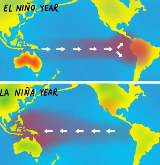
D) “Poor Rainfall” and “Draught Conditions” will emerge due to the development of “STRONG EL NINO” between the third week of July, 2022 and the last week of September, 2022. During the above period conditions will be “Very Hot & Dry” and “Far Above Normal Temperatures” will prevail throughout North and Central States of India. Southern peninsular Indian states will also experience moderately above normal “Dry & Hot conditions. During the above period Squally winds thunderstorms, Sub-Tropical Cyclonic circulations and Tropical Cyclones related rainfalls on isolated periods are forecast. Effective propaganda is must to avoid fatalities due to “KILLER LIGHTNING” from the second week of July till the third week of August, 2022. From the last week of September, 2022 Southwest monsoon will continue till the third week of October, 2022. This will be the second period of best rainfall of Southwest Monsoon 2022. Eastern, Central and Southern peninsular states will get maximum benefits and the West, Northwest will remain mostly dry. Overall 2022 Southwest Monsoon will be Weak & Indifferent with 40 to 50 % Deficit rainfall resulting in “Severe Draught Conditions”. West & Northwest states will be worst affected.
Important dates for Preventive measures:
a) Isolated Heavy to very heavy rainfall due to Sub-Tropical depression, convective activity, localised thunderstorms & Killer lightning (i to iv) are forecast on the following periods:
(i) Between 18th July and 24th July, 2022,(Cloud Burst in north Kashmir @ Kargil) (ii) from 26th July to 31st July, 2022, (locations above the Vindhyas),
(iii) Between 4th August and 12th August, 2022 – Southern peninsular states,
(iv) From 16th August to 20th August, 2022 and again from 23rd August to 29th August, 2022, locations States above the Vindhyas and the central states;
(v) From 3rd September to 6th September, 2022 – Southern peninsular states,
(vi) From 10th September to 12th September, 2022, (Central states & northern part of southern peninsular states),
(vii) From 14th September to 19th September, 2022 (locations above the Vindhyas), and
(viii) Look for a Low pressure system the Bay of Bengal between 21st September and26th September, 2022. This system will become a deep depression, with fairly widespread heavy to very heavy rainfall will cross the Odisha coast on 24th September, 2022 between Paradwip and Chandipur. This system will continue to travel inland dumping heavy to very heavy rainfall till 28th September, 2022. Devastations due to strong winds and flooding are warned during the above period.
(ix) With the beginning of “The second Best Rainfall period of Southwest monsoon” widespread rainfall is forecast from 29th September to 4th, October, 2022, Locations: Central states and below the Vindhyas)
(x) With the Southwest monsoon start withdrawing from the northern states, More widespread rainfall in the central states and northern part of Southern peninsula is forecast between 8th October and 10th October, 2022,
(xi) Widespread heavy to very heavy rainfall with KILLER LIGHTNING is forecast between 12th October, 2022 and 20th October, 2022. With the Onset of Northeast Monsoon during this period, Andhra Pradesh, Telungana, Karnataka and TamilNadu will experience the above conditions.
E) Withdrawal of 2022 Southwest monsoon and the “Onset of Northeast Monsoon 2022” will be simultaneous. Northeast Monsoon will set between 20th & 23rd October, 2022. Beginning with a “Deep depression/Moderate Cyclone” Northeast Monsoon 2022 will yield low pressure trough related rainfall till the first week of January, 2023. Simultaneous ‘Low Pressure systems” in the Bay of Bengal and the Arabian sea are forecast during second week of January, 2023. The Low Pressure system in the Bay of Bengal will become a Cyclone and will cross the coast between Cuddalore and Chennai around 8th January, 2023. Overall “Near Normal rainfall” is forecast for the Northeast monsoon season 2022.
Important dates for Preventive measures:
(i) Light to moderate rainfall is forecast between 23rd October and 26th October, 2022. Andhra Pradesh and north TamilNadu will experience the above conditions, Killer lightning warned during the above period.
(ii) Moderate to heavy rainfall due to a low pressure is forecast between 30th October and 2nd November, 2022. This system will become a depression around 3rd November, 2022 and will cause widespread heavy to very heavy rainfall till it cross the coast between Chennai and Nellore around 5th November, 2022. North TamilNadu and Andhra Pradesh will experience these conditions. Moving into land this system will continue to dump heavy to very heavy rainfall till 9th November, 2022. Andhra Pradesh, Telungana and coastal Odisha will experience these rainfalls. Flash floods are warned during the above periods.
(iii) More moderate to heavy rainfall Landslides and KILLER LIGHTNINGs are forecast between 15th November, 2022 and 7th December, 2022 for Tamilnadu, Andhrapradesh Kerala & east Karnataka. Peak rainfall activity dates: (a) from 15th November, 2022 to 18th November, 2022 (b) from 20th November to 26th November, 2022, (c) from 29th November to 2nd December, 2022, Rainfall will continue till 7th December, 2022,
(iv) Look for Low pressure system becoming a depression between 14th December and 23rd December, 2022. Flooding & Landslides due to widespread heavy to very heavy rainfall is forecast during the above period. Southern, Central districts of TamilNadu, Kerala will experience these conditions more than the northern districts. More widespread rainfall in Central and Northern Tamilnadu is forecast between 27th December and 1st January, 2023,
(v) Between 4th January, 2023 and 10th January, 2023 a depression in the Bay of Bengal will become a Cyclone and will cross the coast between Pondicherry and Nellore around 8th January, 2023. Heavy to very heavy rainfall with strong winds will upset normal life.
(vi) Look for another depression between 12th January and 20th January, 2023south of Gulf of Mannar and west of Colombo. This system will dump heavy to very heavy rainfall from 14th January, 2023 and will breach the northwest SriLanka coast around 19th January, 2023. Devastations due to storms and flooding will upset normal life.
#WINTER 2022: Above the Vindhyas Winter will be Subdued. Heavy to very heavy snowfalls/Icy rainfalls and “Avalanches” are forecast from the beginning of third week of November, 2022 till end of December, 2022. Sub-Himalayan region will experience Spate of Blizzards with Heavy to Very Heavy Snowfall/Icy Rainfall upsetting normal life from the beginning of January, 2023 till early March, 2023. Avalanches are warned during the above period.
Fog, Smog and Air Pollution in the Northern States of India will be “More than what was experienced during 2021”. Meteorologists’ have been ignoring/ not realizing the involvement of “Axis & the plane of active upper air circulations” in causing “More Air Pollution” during certain years of every decade.
Winter over the Southern Peninsula will be “Wet and Warmer”. From the second week of January,2023 till the third week of March 2023 squally winds thunderstorms, Cyclonic Circulation related abnormal rainfall at many places in & around the districts below 10 degree latitude and also at isolated places in the hilly regions are forecast. Flash floods are warned during the above period.
Important dates for Preventive measures:
Well below Sub-Zero Temperatures with heavy to very heavy snowfall/Icy rainfall: (a) From 23rd to 26th November, 2022, (b) from 29th November to 2nd December, 2022, (c) from 6th to 10th December,2022, (d) From 15th to 17th December, 2022 and (e) From 20th to 26th December, 2022.
Massive blizzards and Avalanches are warned between 28th & 31st December, 2022 and again from 2nd January to 7th January, 2023 and till 10th January, 2023.
| #Earthquake Forecast: There could be “Massive Earthquakes, Tsunami” between the second week of October, 2022 and the third week of November, 2022. North Indian Ocean closer to west Sri Lanka could be the location. Important dates for Precautionary measures: (a) 16th October to 20th October, 2022 (Powerful Earthquake), (b) 23rd October to 26th October, 2022 (Massive Earthquake, Tsunami!?) Strong Aftershocks: (c) 31st October to 3rd November, 2022, (d) 7th November to 10th November, 2022 and (e) 15th November to 18th November, 2022 |
RAMACHANDRAN, Astro-Meteorologist.
sesh.ramachandran@gmail.com
https://www.facebook.com/ramachandran.seshadri
https://twitter.com/seshchandran?s=08
Leave a Reply
You must be logged in to post a comment.