
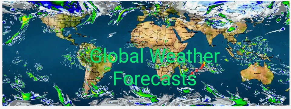

VEDIC METEOROLOGY
2021 GLOBAL WEATHER FORECAST
Forecast by: ‘Puyal’ Ramachandran
I extend from the bottom of my heart my sincere PRANAMS/THANKS to all those people from different parts of the World for their overwhelming recognition, appreciation and encouragement for my research. Their overwhelming following of my forecasts especially my 2020 GLOBAL WEATHER FORECAST prompted me to register the accuracy of my forecasts. Please check my forecasts @ https://tamilnadumandram.com & also https://independent.academia.edu/RamachandranSeshadri
I have been validating my forecast with the matching weather events as and when they unfold and have been posting them in my “Twitter page” & in my ”Face book page”.
https://twitter.com/seshchandran?s=08
https://www.facebook.com/ramachandran.seshadri
Right from the First “BLIZZARDS “in the Midwest & Northeast USA, “CELL STORMS, SEVERE FLOODING” in Australia, from the First to the last “TYPHOONS “in the Pacific, from the First “Tropical Cyclone ‘ARTHUR’ to the last Hurricane “IOTA” of the 2020 Atlantic Hurricane season; “CATOSTROPHIC FLOODS in China”, Europe, African countries and the “KILLER LIGHTNING FATALITIES” in India were exactly matching my forecast dates. The one Glaring Contrariety was my forecast of “EL NINO” during this year. As per World Meteorological centres. there was “No” ‘El Nino’ this year; but they are yet to submit their autopsy report for the “RECORD EXTREME HOT CONDITIONS” in Siberia and the Arctic. I humbly say that the army of Modern Meteorologists’ mandatory dependence on Observational data even for their “VAGUE FORECASTS” a fortnight in advance expose the limitations of the science they depend on. It’s obvious that it is “Impractical, Unimaginable” for access to “Observational data” YEARS IN ADVANCE; yet the “ULTIMATE FUNDAMENTALS” of “Vedic Meteorology’s Science” allows even a NOVICE like me to provide ‘Dependable Specific Long Range Weather Forecast’.
MAIN POINTS:
1) (A) Between the First week of December, 2020 and the Third week of February, 2021 the northern hemisphere mid-latitude region will experience “Severe Winter condition”. From last days of December, 2020 till the third week of February, 2021 “Spate of Blizzards, Heavy snowfall, Avalanches and Icy rainfall are forecast”. These conditions will prevail in the North American continent, the Europe, Turkey, Central Asia, China, Japan & North Indian states bordering the Himalayas. 2021 Winter will be “Warmer & Daytime Temperature will remain ‘Above Normal’.
1) (B) During the same period the Mid-latitude region of the southern hemisphere will experience Very Hot conditions and register “Far Above Normal Temperatures. “Negative Indian Ocean Dipole” will emerge from the last week of December, 2020 and till the third week of February, 2021. There will be Typhoons, Tropical cyclones, squally winds, Thunderstorms, Cell storms and Convective precipitations. These conditions will also prevail in Latin American countries, Central and southeast African countries, South Indian ocean countries, Indonesia, South Pacific countries, Australia and countries around it.
2 (A) Between the Third week of February, 2021 and the last week of March, 2021 the northern hemisphere mid-latitude region will experience; “WET & HUMID SPRING. “Few Blizzards with Massive Snowfalls, but more Icy rainfalls” are forecast. During the same time Heavy to Very heavy “Incessant & Torrential” rainfall will cause WIDESPREAD CATOSTROPHIC FLOODINGS. Till the last week of February, 2021 “Avalanches & Landslides/Mudflows” will cause devastations & fatalities. These conditions will prevail in the North American continent, the Europe, Turkey, Central Asia, China, Japan and the North Indian states bordering the Himalayas. Average daytime temperatures will be “Above Normal” during the above period.
2 (B) Between the Third week of February, 2021 and the last week of March, 2021 the Mid-latitude region of the southern hemisphere and the tropical region will experience “Incessant & Torrential” Heavy to Very Heavy Rainfall causing “WIDESPREAD CATOSTROPHIC FLOODINGS”. Till the last week of February, 2021 the ‘Mid Altitude & Hilly regions’ will experience record rainfall resulting in devastations due to “Flash Floods, Landslides and Mudflows”. These conditions will prevail in Latin American countries, Central and southeast African countries, Middle East, South Indian ocean region and South Pacific countries, Australia, New Zealand, Indonesia and countries around it. Average daytime temperatures will be “Above Normal” during the above period.
3) (A) There will be TWO distinctively different weather conditions between the last week of March, 2021 and the first week of June,2021. During the above period northern hemisphere mid-latitude region and its tropical region will experience (i) from the last week of March, 2021 till the third week of April,2021; Tropical Cyclones, Extra-tropical cyclones, spate of Tornadoes, multiple thunderstorms, hailstorms and “KILLER LIGHTNING” will cause devastations and (ii) between the last week of April, 2021 and the first week of June,2021; Sub-tropical systems, Typhoons, Cyclones, Tornadoes and thunderstorms will dump heavy to very heavy rainfall at “Fairly widespread areas” causing SEVERE FLOODING & Devastations. The FIRST Tropical Cyclone/Hurricane in the ATLANTIC is forecast during the Last week of May, 2021. During the periods it will be “Progressively Hot with Above normal Temperatures will be registered”. These conditions will prevail in the North American continent, the Europe, Turkey, Middle-East countries, Central Asia, China, Japan & North Indian states bordering the Himalayas.
3) (B) The Mid-latitude region of the southern hemisphere and the tropical region will experience TWO distinctively different weather conditions between the last week of March, 2021 and the first week of June,2021;.(i) between the last week of March,2021 and the third week of April,2021 Tropical Cyclones, Thunderstorms, Tornadoes ,Sandstorms are forecast. (ii) Fairly widespread moderate/heavy rainfall with thunderstorms/localised storms are forecast between the last week of April,2021 and the first week of June,2021. During the second half of the above period “CLOUDBURST” and Landslides/Mudflows are forecast. These conditions will prevail in Latin American countries, Central & southeast African countries, South Indian ocean region & South Pacific countries, Australia, New Zealand, Southeast Asian countries and South Asian countries. I reiterate that “Australia will Enjoy BOUNTYFUL MONSOON IN 2021 after years of drought” as forecasted in my 2020 Global weather forecast.
4) (A & B) From the first week of June,2021 till the last week of September,2021 there will be TWO distinctively different weather conditions; (i) Between the first week of June,2021 and the first week of August,2021 Spate of Hurricanes, Typhoons, Tropical Cyclones, Tornadoes, Extratropical cyclones, thunderstorms etc., are forecast. Devastations due to Strong gusts, Severe Flooding, Landslides/Mudflows are warned during the above period. This will be “First Active period of 2021 Atlantic Hurricane season” and (ii) Between the second week of August,2021 and the last week of September,2021 There will be few Hurricanes, Typhoons, Tropical Cyclones but “More Widespread Torrential Heavy to Very Heavy rainfall will cause CATOSTROPHIC FLOODS. During this period “KILLER LIGHTNINGS” LANDSLIDES/MUDFLOWS are warned. These conditions will prevail in the North American continent, the Europe, Turkey, Central Asia, China, Japan & North Indian states bordering the Himalayas, Peninsular India, South Asian countries and Equatorial & Southern tropic of Latin American countries. The Northeast, Central, equatorial African countries and the Middle East will also experience these conditions. During the period (ii) African countries below tropic of Capricorn and South Pacific countries Australia, New Zealand will experience Progressively Warm Spring with heavy to Very heavy rainfall and mild snowfall/ Icy rainfall.
5) (A & B) Between the beginning of October,2021 and the first fortnight of January, 2022 there will be TWO distinctively different weather conditions. (i) Between the beginning of October, 2021 & the last week of November, 2021 the Atlantic Hurricane season will experience THE SECOND ACTIVE PERIOD of 2021, Similarly the Pacific and the Tropical regions will also experience VERY HIGH ACTIVITIES of Typhoons and Tropical Cyclones. During the above period there will be at least THREE Very Powerful Storm Systems of more than Category 3+ in all regions. CATOSTROPHIC DEVASTATIONS and fatalities can be avoided/minimized by Advance Disaster Preparedness. During this period “TEMPERATURES will remain FAR ABOVE NORMAL” and (ii) From the last week of November,2021 till the first fortnight of January,2022 Strong Winter Conditions will emerge. Massive Snowfalls/Icy Rainfalls but with less Blizzards are forecast during the above period. These conditions will prevail in the North American continent, the Europe, Central Asia, Turkey, China and Japan. The North Indian states bordering the Himalayas, Peninsular India, South Asian countries, Equatorial & Southern tropic of Latin American countries, Northeast, Central, equatorial African countries and the Middle East will also experience these conditions.
# In the South Indian Ocean region, African countries around tropic of Capricorn and South Pacific countries Australia, New Zealand, During the above mentioned period:
(i) From the beginning of October,2021 till the last week of November, 2021, The Spring weather will turn to ‘Very Hot & Severe Summer Conditions” registering “FAR ABOVE NORMAL TEMPERATURES.” During this period squally winds with thunderstorms, KILLER LIGHTNINGS and Powerful Tropical Cyclones are warned.
(ii) From the last week of November,2021 till the first fortnight of January,2022 Excellent Pre-monsoon rainfall is forecast for the above locations. Tropical Cyclones, Extratropical cyclones, Severe Thunderstorms with Heavy to Very Heavy rainfall coupled with Killer lightnings are forecast. Devastations due to storms and SEVERE FLOODING, Landslides/Mudflows will cripple normal life. The above conditions will merge with the beginning of 2022 Australian Monsoon. The monsoon will be fluctuating till the first week of April,2022; and VOLATILE WEATHER CONDITIONS will emerge due to a “Positive Indian Ocean Dipole” till the third week of May,2022. Australia will get ABOVE NORMAL RAINFALL for the second year in a row.
DETAILED FORECAST:
1) (A) Between the First week of December, 2020 and the Third week of February, 2021 the northern hemisphere mid-latitude region will experience “Severe Winter condition”. From last days of December, 2020 till the third week of February, 2021 “Spate of Blizzards, Heavy snowfall, Avalanches and Icy rainfall are forecast”. These conditions will prevail in the North American continent, the Europe, Turkey, Central Asia, China, Japan & North Indian states bordering the Himalayas. 2021 Winter will be “Warmer & Daytime Temperature will remain ‘Above Normal’.
Important dates for disaster preventive measures:
a) Between 30th December, 2020 and 7th January,2021 Powerful Blizzards similar to Polar Vertex/Arctic Blast will dump heavy to very heavy snowfall. Bomb Cyclone with heavy to very heavy icy rainfall is also forecast during the above period. Massive pile ups and floods will cripple normal life during the above period.
b) Between 9th January,2021 and 15th January,2021 another set of Powerful Blizzards will dump heavy to very heavy snowfalls and Bomb Cyclone with heavy to very heavy icy rainfall are forecast. Devastations and Severe flooding will upset normal life.
c) Between 19th January,2021 and 27th January,2021 series of Blizzards with heavy to very heavy snowfall will cripple normal life. During the same period look for another Bomb Cyclone with heavy to very heavy icy rainfall will cause severe damages and flooding.
d) Another Severe Bomb Cyclone with Heavy to Very Heavy icy rainfall will cause severe damages to life property between 29th January,2021 and 8th February,2021. During the same period Powerful Blizzards with heavy to very heavy snowfall and Avalanches will cause devastations.
e) Between 10th February,2021 and 14th February, 2021 Blizzards with Heavy to Very Heavy snowfall/Icy rainfall and Avalanches will upset normal life and
(f) Between 15th February, 2021 and 22nd February,2021 Blizzards with heavy to very heavy snowfall/icy rainfall are forecast. Avalanches and Massive pile ups will upset normal life. Europe may experience these conditions more than North American continent.
1) (B) During the same period the Mid-latitude region of the southern hemisphere will experience Very Hot conditions and register “Far Above Normal Temperatures. “Negative Indian Ocean Dipole” will emerge from the last week of December, 2020 and till the third week of February, 2021. There will be Typhoons, Tropical cyclones, squally winds, Thunderstorms, Cell storms and Convective precipitations. These conditions will also prevail in Latin American countries, Central and southeast African countries, South Indian ocean countries, Indonesia, South Pacific countries, Australia and countries around it.
Important dates for disaster preventive measures:
a) Look for a Powerful Tropical Cyclone/Typhoon between 30th December, 2020 and 8th January, 2021. Countries in the Southwest Indian Ocean, Southeast Pacific Ocean and Latin America will be affected.
b) Look for a Powerful Typhoon/Tropical Cyclone between 10th January,2021 and 29th January, 2021. During the above period Heavy to Very Heavy rainfall with squally winds/thunderstorms are warned on the following periods: 10th to 15th January,2021 and 19th to 21st January,2021. The Typhoon/Tropical Cyclone (category 3+) will cross the coast (between 11 & 16-degree North Latitude & E longitude) around 24th January, 2021 and swing around continue till 29th January,2021.
c) Look for another Powerful Typhoon/Tropical Cyclone (category 3+) between 1st February, 2021 and 10th February,2021. During the above period Heavy to Very Heavy rainfall with squally winds/thunderstorms. Devastations to life and property due to Severe flooding, Landslides/Mudflows in Southwest Indian Ocean Australian east coast and Latin American countries are warned.
d) Between 10th February, 2021 and 21st February,2021 another set of Typhoon/Tropical Cyclones are warned. These systems will cross the coast (between 15 & 19-degree N Lat. & E long.), Devastations to life and property due to Severe flooding, Landslides/Mudflows are warned during the above periods.
2 (A) Between the Third week of February, 2021 and the last week of March, 2021 the northern hemisphere mid-latitude region will experience; “WET & HUMID SPRING. “Few Blizzards with Massive Snowfalls”, but more “Icy rainfalls” are forecast. During the same time Heavy to Very heavy “Incessant & Torrential” rainfall will cause WIDESPREAD CATOSTROPHIC FLOODINGS. Till the last week of February, 2021 “Avalanches & Landslides/Mudflows” will cause devastations & fatalities. These conditions will prevail in the North American continent, the Europe, Turkey, Central Asia, China, Japan and the North Indian states bordering the Himalayas. Average daytime temperatures will be “Above Normal” during the above period.
Important dates for disaster preventive measures:
a) “Incessant & Torrential” Snowfall/Icy rainfall with Heavy to Very heavy spells will cause WIDESPREAD CATOSTROPHIC FLOODINGS. Peak activity period as per forecast: (i) 25th & 26th February,2021, (ii) 2nd March to 6th March,2021, (iii) 10th March to 14th March,2021 and (iv) 18th March to 22nd March,2021.
2 (B) Between the Third week of February, 2021 and the last week of March, 2021 the Mid-latitude region of the southern hemisphere and the tropical region will experience “Incessant & Torrential” Heavy to Very Heavy Rainfall causing “WIDESPREAD CATOSTROPHIC FLOODINGS”. Till the last week of February, 2021 the ‘Mid Altitude & Hilly regions’ will experience record rainfall resulting in devastations due to “Flash Floods, Landslides and Mudflows”. These conditions will prevail in Latin American countries, Central and southeast African countries, Middle East, South Indian ocean region and South Pacific countries, Australia, New Zealand, Indonesia and countries around it. Average daytime temperatures will be “Above Normal” during the above period.
Important dates for disaster preventive measures:
(a) “Incessant & Torrential” rainfall with Heavy to Very heavy spells will cause WIDESPREAD CATOSTROPHIC FLOODINGS. Peak activity period as per forecast: (i) Look for a Sub-Tropical cyclonic system will dump heavy to very heavy rainfall between 26th February, 2021 and 2nd March,2021, (ii) Between 5th March,2021 & 7th March,2021, (iii) Between 10th March, 2021 & 14th March, 2021 and (iv) Between 19th March,2021 & 22nd March,2021.
3) (A) There will be TWO distinctively different weather conditions between the last week of March, 2021 and the first week of June,2021. During the above period northern hemisphere mid-latitude region and its tropical region will experience (i) from the last week of March, 2021 till the third week of April,2021; Tropical Cyclones, Extra-tropical cyclones, spate of Tornadoes, multiple thunderstorms, hailstorms and “KILLER LIGHTNING” will cause devastations and (ii) between the last week of April, 2021 and the first week of June,2021; Sub-tropical systems, Typhoons, Cyclones, Tornadoes and thunderstorms will dump heavy to very heavy rainfall at “Fairly widespread areas” causing SEVERE FLOODING & Devastations. The FIRST Tropical Cyclone/Hurricane in the ATLANTIC is forecast during the Last week of May, 2021. During the periods it will be “Progressively Hot with Above normal Temperatures will be registered”. These conditions will prevail in the North American continent, the Europe, Turkey, Middle-East countries, Central Asia, China, Japan & North Indian states bordering the Himalayas.
Important dates for disaster preventive measures:
i) Look for Powerful Tropical Cyclone/Typhoon between 28th March,2021 and 7th April,2021. Gaining strength and speed around 3rd April,2021 this system will cross the coast around 6th April,2021. Devastations due to powerful gusts and flooding due to heavy to very heavy rainfall will cripple normal life. The residual low pressure system will dump moderate to heavy rainfall between 10th & 11th April,2021. Tornadoes are warned during the above periods.
ii) Another Strong Tropical Cyclone/Typhoon/Hurricane is forecast between 13th April, 2021 and 21st April,2021. This system will weaken near the coast around 19th April,2021. Flooding due to heavy to very heavy rainfall during the above period will upset normal life. Rainfall will continue till 23rd April,2021.
iii) Sub-tropical/Extra-Tropical Cyclonic system associated heavy to very heavy rainfall is forecast between (a)26th April,2021 and 29th April,2021, (b) between 3rd and 6th May,2021, (c) between 10th May,2021 and 15th May,2021 and (d) 18th May,2021 and 20th May,2021. Tornadoes are warned during the above periods.
iv) Tropical Cyclone/Typhoon/Hurricane is forecast between 23rd May,2021 and 28th May,2021. This system will cross the coast around 27th/28th May, 2021 with powerful gusts and flooding due to heavy to very heavy rainfall like” CLOUDBURST” will upset normal life. Central America likely to be one among the locations with an early hurricane of 2021 season. This system will ‘SWING AROUND’ and cross the coast again @ 4th June, 2021 and cause Severe Flooding due to CLOUDBURSTs”. Killer lightnings, Severe Landslides/Mudflows are warned between 27th May,2021 and 4th June,2021. Tornadoes are warned during the above periods.
3) (B) The Mid-latitude region of the southern hemisphere and the tropical region will experience TWO distinctively different weather conditions between the last week of March, 2021 and the first week of June, 2021; (i) between the last week of March,2021 and the third week of April,2021 Tropical Cyclones, Thunderstorms, Tornadoes, Sandstorms are forecast. (ii) Fairly widespread moderate/heavy rainfall with thunderstorms/localised storms are forecast between the last week of April,2021 and the first week of June,2021. During the second half of the above period “CLOUDBURST” and Landslides/Mudflows are forecast. These conditions will prevail in Latin American countries, Central & southeast African countries, South Indian ocean region & South Pacific countries, Australia, New Zealand, Southeast Asian countries and South Asian countries. I reiterate that “Australia will Enjoy BOUNTYFUL MONSOON IN 2021 after years of drought” as forecasted in my 2020 Global weather forecast.
Important dates for disaster preventive measures:
i) Look for a Powerful Tropical Cyclone(s) between 28th March, 2021 and 7th April, 2021. This system will swing and cross the coast around 7th April, 2021. Devastations due to strong storms and flooding due to heavy to very heavy rainfall are warned during the above period.
ii) Another set of Tropical Cyclones are warned between 10th April,2021 and 17th April, 2021. The cyclone will cross the coast around 16th April, 2021. These systems continue to dump heavy to very heavy rainfall till 22nd April, 2021 causing Severe Flooding.
iii) Heavy to Very Heavy rainfalls due to Favourable upper air circulations, Convective activities are forecast on the following periods:
(a) 26th to 29th April,2021, (b) 3rd to 6th May, 2021, (c) 10th to 15th May, 2021, (d) 19th May to 22nd May, 2021, Anti-Cyclonic circulations between the first and the last week of May,2021 will impact rainfall.
iv) Look for a Powerful Tropical Cyclones/Hurricane between 24th May, 2021 and 4th June, 2021. Devastations due to strong gusts and severe flooding due to heavy to very heavy rainfall are warned. These systems will cross the coasts more than once and on each occasion causing “CLOUDBURSTS”.
4) (A & B) From the first week of June,2021 till the last week of September,2021 there will be TWO distinctively different weather conditions; (i) Between the first week of June,2021 and the first week of August,2021 Spate of Hurricanes, Typhoons, Tropical Cyclones, Tornadoes, Extratropical cyclones, thunderstorms etc., are forecast. Devastations due to Strong gusts, Severe Flooding, Landslides/Mudflows are warned during the above period. This will be “First Active period of 2021 Atlantic Hurricane season” and (ii) Between the second week of August,2021 and the last week of September,2021 There will be few Hurricanes, Typhoons, Tropical Cyclones but “More Widespread Torrential Heavy to Very Heavy rainfall will cause CATOSTROPHIC FLOODS. During this period “KILLER LIGHTNINGS”, LANDSLIDES/MUDFLOWS are warned. These conditions will prevail in the North American continent, the Europe, Turkey, Central Asia, China, Japan & North Indian states bordering the Himalayas, Peninsular India, South Asian countries and Equatorial & Southern tropic of Latin American countries. The Northeast, Central, equatorial African countries and the Middle East will also experience these conditions. During the period (ii) African countries below tropic of Capricorn and South Pacific countries Australia, New Zealand will experience Progressively Warm Spring with heavy to Very heavy rainfall and mild snowfall/ Icy rainfall.
Important dates for disaster preventive measures: (First part)
i) Look for Powerful Tropical Cyclone, Typhoon and Hurricane between 6th June,2021 and 12th June,2021. During this period the potential of the storm systems will be of “Category 2”. (Landslides/Mudflows)
ii) Another set of Tropical cyclone, Typhoon, Hurricane are forecast between 14thJune,2021 & 24th June,2021. During this period the potential of the storm systems will be “Category 2+”. (Landslides/Mudflows)
iii) Look for Powerful Tropical Cyclone, Typhoon and Hurricane between 30th June,2021 and 12th July, 2021. During this period the potential of the storm systems will be “Category 3+”.
iv) Next set of Tropical Cyclone, Typhoon and Hurricane are forecast between 16th July,2021 & 23rd July,2021. During this period the potential of the storm systems will be “Category 2”.
v) Next set of Powerful Tropical Cyclone, Typhoon and Hurricane between 26th July, 2021 & 9th August,2021. During this period the potential of the storm systems will be “Category 3+”. (CLOUDBURSTS warned)
Important dates for disaster preventive measures: (Second part)
Peak activity periods of Widespread Torrential Heavy to Very Heavy rainfall causing CATOSTROPHIC FLOODS, “KILLER LIGHTNINGS” and LANDSLIDES/MUDFLOWS:
a) 14th August to 19th August, 2021, (b) 21st August to 23rd August,2021, (c) 25th August to 27th August,2021, d) 29th August to 31st August, 2021, (e) 4th September to 6th September, 2021, (f) 8th September to 15th September, 2021, (g)19th September to 22nd September, 2021, (h) 28th September to 30th September, 2021(Beginning of more severe activities of the above warnings).
5) (A & B) Between the beginning of October,2021 and the first fortnight of January, 2022 there will be TWO distinctively different weather conditions. (i) Between the beginning of October, 2021 & the last week of November, 2021 the Atlantic Hurricane season will experience THE SECOND ACTIVE PERIOD of 2021, Similarly the Pacific and the Tropical regions will also experience VERY HIGH ACTIVITIES of Typhoons and Tropical Cyclones. During the above period there will be at least THREE Very Powerful Storm Systems of more than Category 3+ in all regions. CATOSTROPHIC DEVASTATIONS and fatalities can be avoided/minimized by Advance Disaster Preparedness. During this period “TEMPERATURES will remain FAR ABOVE NORMAL” and (ii) From the last week of November,2021 till the first fortnight of January,2022 Strong Winter Conditions will emerge. Massive Snowfalls/Icy Rainfalls but with less Blizzards are forecast during the above period. These conditions will prevail in the North American continent, the Europe, Central Asia, Turkey, China and Japan. The North Indian states bordering the Himalayas, Peninsular India, South Asian countries, Equatorial & Southern tropic of Latin American countries, Northeast, Central, equatorial African countries and the Middle East will also experience these conditions.
# In the South Indian Ocean region, African countries around tropic of Capricorn and South Pacific countries Australia, New Zealand, During the above mentioned period:
(i) From the beginning of October,2021 till the last week of November, 2021, The Spring weather will change to ‘Very Hot & Severe Summer Conditions” registering “FAR ABOVE NORMAL TEMPERATURES.” During this period squally winds with thunderstorms with KILLER LIGHTNINGS, Powerful Tropical Cyclones are warned.
(ii) From the last week of November,2021 till the first fortnight of January,2022 Excellent Pre-monsoon rainfall is forecast for the above locations. Tropical Cyclones, Extratropical cyclones, Severe Thunderstorms with Heavy to Very Heavy rainfall coupled with Killer lightnings are forecast. Devastations due to storms and SEVERE FLOODING, Landslides/Mudflows will cripple normal life. The above conditions will merge with the beginning of 2022 Australian Monsoon. The monsoon will be fluctuating till the first week of April,2022; and VOLATILE WEATHER CONDITIONS will emerge due to a “Positive Indian Ocean Dipole” till the third week of May,2022. Australia will get ABOVE NORMAL RAINFALL for the second year in a row.
Important dates for disaster preventive measures: (5) (A & B) Part(i)
i) Between 2nd October, 2021 and 13th October, 2021 look for Powerful Tropical Cyclone, Typhoon and Hurricane. These systems will be of “Category 3” strength & will cross the coasts around 12th October, 2021. Devastations due to strong gusts, Severe flooding due to heavy to very heavy rainfall (CLOUD BURSTs) and “Landslides/Mudflows are warned.
ii) Next set of Powerful Tropical Cyclone, Typhoon and Hurricane are warned between 16th October, 2021 and 24th October, 2021. These systems will be of “Category 3+” strength. At some locations these systems will continue to travel on land and dump “Heavy to Very Heavy rainfall” between 27th & 30th October, 2021.
iii) Between 27th October, 2021 and 5th November, 2021 look for Powerful Tropical Cyclone, Typhoon and Hurricane. These systems will be of “Category 3+” strength. Around 3rd November, 2021 these systems will cross the coast with heavy to very heavy rainfall (CLOUDBURSTs). Killer lightnings and Landslides/Mudflows are warned.
iv) Next set of Powerful Tropical Cyclone, Typhoon and Hurricane are forecast between 8th November, 2021 and 20th November, 2021. These systems will be of “Category 2+” strength. These systems will cross the coast more than once. Severe flooding due to heavy to very heavy rainfall coupled with killer lightnings will cripple normal life. (Peak activities warned between 10th & 13th November and 18th & 20th November, 2021).
Important dates for disaster preventive measures: Part(ii)
i) Blizzards with heavy to very heavy snowfall/Icy rainfall are forecast on 27th & 28th November, 2021. With the plunge of POLAR VERTEX between 2ndDecember and 5thDecember, 2021 Blizzards with heavy to very heavy snowfall and Icy rainfall are warned.
ii) More powerful blizzards with heavy to very heavy snowfall/Icy rainfall are warned between7th December and 11th December, 2021 and again between 17th December and 20th December, 2021.
iii) Between 26th December, 2021 & 2nd January, 2022 and again between 5th January, and 13th January, 2022 Very powerful blizzards with heavy to very heavy snowfall/Icy rainfall are warned.
More widespread heavy to very heavy snowfalls/Icy rainfalls will continue till the third week of February, 2022. Avalanches are warned from middle of January, 2022 till the first week of February, 2022. With “Massive Blizzards towards the second week end of February, 2022.
From the second week of February till the first week of april,2022 “Warmer and Wet Spring” is forecast.
First North Atlantic Tropical Cyclone/Hurricane of 2022 is forecast during late March and early April,2022.
RAMACHANDRAN, Astro-Meteorologist.
sesh.ramachandran@gmail.com https://www.facebook.com/ramachandran.seshadri

World weather forecast 2021
Leave a Reply
You must be logged in to post a comment.